The weather page is prepared by Daniel Bezte. Dan has a BA Honours degree in geography, specializing in climatology, from the U of W. He has taught climate and weather classes at the U of W, and is a guest climate expert on CJOB’s morning show with Larry Updike. Daniel runs a computerized weather station on his 10 acres near Birds Hill Park, which he plans to develop into a small vegetable and fruit hobby farm.
Daniel welcomes questions and comments at [email protected]
Read Also

June brings drought relief to western Prairies
Farmers on the Canadian Prairies saw more rain in June than they did earlier in the 2025 growing season
Idon’t know about you, but once we hit early March, I am pretty much tired of winter and can hardly wait for spring to finally arrive. A few years ago I took a brief look at when spring arrives on average and I felt that we should take another look at this again this year.
Looking back over the last 30 years of data trying to determine when spring starts, I decided that for spring to have officially sprung, the majority of snow needs to have melted and daytime high temperatures (for the most part) need to be consistently above +5C or better. Using Winnipeg’s data as an average for southern Manitoba, I found that spring has arrived as early as March 17 in 1981 and 2000, and as late as April 29 in 1996 and April 26 in 1997. When I tried to determine the average date for spring’s arrival, I found that the majority of the dates fell into the week of April 5-12. When I did comparisons against Brandon’s records, I found that spring usually arrived around one week earlier in the southwestern region, due mostly to lower snow cover and higher elevation.
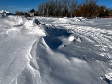
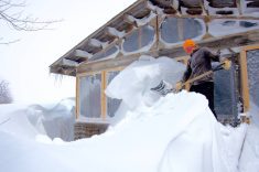
I also found that nearly every year with a late spring had significant snow cover going into April. What always amazes me is how quick the snow pack can disappear. For most years it seems that when spring decides it’s time to make an appearance, it only takes a few days for it to take hold. Whether it’s March or April, or whether we have 10 or 40 cm of snow on the ground, when spring arrives it’s usually with a vengeance. Under the strong spring sunshine (mid-April sunshine is equivalent to late August in strength), even the deepest snow pack can be literally wiped out in less than a week. An example of this was in 1955, a record year for snowfall. On March 29 of that year there were 51 cm of snow on the ground in Winnipeg; by April 4, pretty much all of it had melted.
COOLING EFFECT
So, when should we expect to see temperatures warm enough to melt all this snow? Well, the basic answer lies within the snow – literally. How many of us have headed out on a warm spring day and have gone for a visit to the local swimming hole or lake? What did you end up experiencing? I would bet that if there were a wind blowing off the lake you would have noticed how much colder it felt. This is due to the cold water and ice on the lake cooling down the air around it. The same thing holds true when there is snow on the ground.
Snow acts in a number of ways to keep air temperatures down. First of all, snow, being the frozen state of water, is by its very definition cold. Secondly, if you remember back to your junior high or high school science, you’ll hopefully remember that to change a solid to a liquid (melting) requires energy, and in this case the energy is heat. Thirdly, snow is usually white and white objects do a remarkably good job of reflecting sunshine. So if we have a large area, such as Manitoba, covered in snow, and we have above-zero air moving into the region, the snow itself acts to cool the air as it comes in contact with it.
Along with this, as the heat of the air interacts with the snow, that heat is used to melt the snow instead of heat the air, and it takes a lot of heat to melt snow. In fact, it takes almost as much heat to melt snow as it does to bring water to the boiling point. Finally, if the ground is covered in snow, it acts as a very efficient reflector of sunshine, reflecting much of the sun’s energy back toward space, whereas black soil will absorb the sun’s energy and, in turn, heat the air around it.
Now there can always be exceptions to this. Very warm air can move into our region or local conditions could be just right, and even with all the snow around, temperatures can get quite warm, but to see temperatures over 10C you pretty much need no snow on the ground.
A LOOK AHEAD
Will we see a continuation of the relatively warm start we have had this March? The long-range models show the same basic pattern continuing for the next couple of weeks, which will take us close to the end of the month, but the real question is whether we will see any more snow.
If we continue to dodge the snowstorms like we have and we don’t get any more snow, then I wouldn’t be surprised if some regions are snow free well before the end of March. The big question will then be if we can actually get a nice warm April – something we will look at next week.