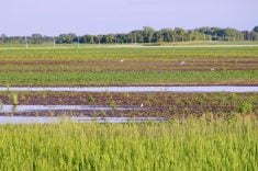
Last issue’s forecast did a good job overall, but it was off a little bit in the timing of the systems and the behaviour of the big storm system that hit a large part of southern and central Manitoba on May 19-20. The original forecast called for a low to track through on Thursday, May 19, but that low came a day early. Then, the long-weekend Colorado low did not materialize as expected. Instead, a strong area of low pressure formed farther north and tracked through our region on Thursday and Friday, instead of the Friday and Saturday of the long weekend. Although we got more unwanted rain, at least the long weekend was not impacted.
I think the question on everyone’s mind, or maybe two questions, are:
- Are we finally done with the rain? and
- Is it ever going to warm up?
Well, I am not so sure about being done with the rain, but there are indications that warmer temperatures will be moving in.
This forecast period looks like it will start with a weak area of low pressure tracking through central regions, bringing with it a mix of sun and clouds along with the slight chance of a shower late on Wednesday or early Thursday. The weather models then show a large area of low pressure developing to our southwest. A strong southerly flow will develop ahead of this feature, which should help boost temperatures into the low to mid-20s by the end of the week. This low is forecast to move into the northern Prairies over the weekend, keeping us on the warm side of the low. We may see the odd thundershower over the weekend as the warm front associated with this low lifts northward through our region.
To begin the week of May 30, the GFS weather model shows a continuation of warm temperatures as the overall flow becomes southwesterly. Southwesterly flows usually mean unsettled weather, which equals more rain, or at least the chance for it. There has not been a lot of consistency with the weather model this far out, but it does show a couple of areas of low pressure developing to our southwest and then ejecting north or northeastward. These lows look much more summer-like in nature, which means if they do develop and move in our direction, we would see thundershowers and thunderstorms instead of steady rain. They will also likely move quicker, allowing for more sunshine in between systems.
Usual temperature range for this period: highs, 16 to 27 C; lows, 3 to 13 C.


