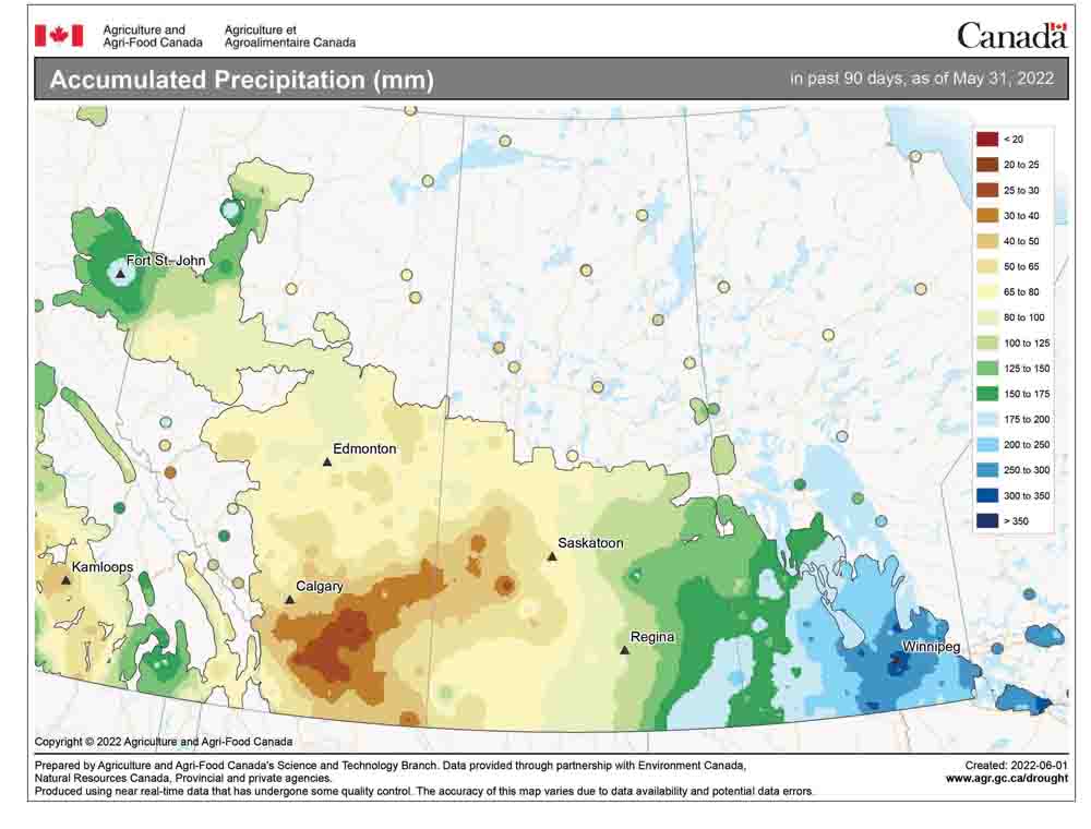
If you recall back to last week’s forecast, there was some disagreement between the two main weather models. The second weather model was the one that got our last forecast correct, which was unfortunate for us, as the sixth Colorado low in the last two months brought us more rain and cool temperatures. This low moved well north of us before stalling and then retrograding westward, then slumping back down toward southern and central regions late last week. This upper low brought cold early June temperatures along with plenty of wind.
For this forecast period, it looks like we will see warmer and drier conditions, but it is not looking like summer will suddenly burst onto the scene, even though it might feel this way, considering how cool it has been. Relying on the weather model that got last week’s forecast correct, it looks like a weak high pressure will drift through our region, bringing with it sunny to partly cloudy skies along with near-average temperatures. Expect daytime highs to be in the low 20s, with overnight lows falling to around 10 C.
Over the weekend, this high will strengthen as it drifts off to our south. At the same time, an area of low pressure is forecast to begin developing to our west. This will allow for a warm southerly flow to begin influencing our region. Expect daytime highs to warm to around 23 to 25 C with overnight lows in the 12 C range. We could see the odd late-day shower as bits of energy from the western low break off and zip eastward.
Read Also
Forecasting spring 2026 weather on the Prairies
What weather can farmers expect across Manitoba, Alberta and Saskatchewan as they head into seeding? Plus: a lesson on what makes the seasons turn
This western low looks like it might bring some much-needed rain to parts of Alberta and western Saskatchewan early in the week of June 13, but not impact us too much. Currently, it looks like this low will break apart as it moves eastward around the middle of the week, bringing with it a small chance for some showers and thundershowers around Wednesday, June 15.
Usual temperature range for this period: highs, 19 to 28 C; lows, 6 to 15 C.


