I think we knew it was going to happen. After nearly a month of very accurate computer-modelled medium-range forecasts, things slipped a bit.
The forecasted trough of low pressure that was to move out of our region at the start of last issue’s forecast took much longer to move through, which impacted the timing and movement of all the systems that followed.
There is also a lot of uncertainty with this forecast period, which makes confidence in this forecast low. The weather models are jumping around with drastically different forecasts from one model run to the next. It looks like this forecast period will begin with a push of mild air as a large trough of low pressure over Eastern Canada shifts eastwards, allowing for a ridge of high pressure to our west to build eastwards. This should allow temperatures to moderate into the 5 to 8 C range on Thursday and Friday. Over the weekend, arctic high pressure looks to drop southwards behind a large low pressure forecasted to develop over the central U.S. This will drop daytime highs back down to around 0°.
Read Also

VIDEO: Here’s Manitoba’s 2026 spring storm forecast
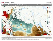
Weather models are calling for above-average precipitation in southern Manitoba, with at least two more Alberta clippers possible.
To start the week of November 8, the weather models are showing the large low to our south pulling off to the East Coast allowing for another ridge of high pressure to begin building over our region. Should this happen, we should expect to see plenty of clear skies along with milder temperatures. Daytime highs look like they will once again push into the 5 to 8 C range with overnight lows falling to around -4 C.
Looking further ahead, there is a hint that we could see a little snow around the weekend of November 13-14 but with the models being so inconsistent, I would not hold my breath.
Usual temperature range for this period: highs: -2 to 10 C; lows: -11 to 1 C.
Probability of precipitation falling as snow: 60 per cent.