Hard to believe the first month of 2022 is already over. After a warm start to this winter, we saw the weather pattern switch to a much colder one in late December and that cold pattern stuck around for a good part of January. Unless you went away for all of January, you pretty much know it was a colder-than-average month; the question is, just how cold was it?
The data from our three main reporting locations — Winnipeg, Brandon, and Dauphin — all showed mean monthly temperatures between 1.5 and 3.0 C below the long-term average. The cold spot, both compared to average and in actual terms, was Winnipeg, with a mean monthly temperature of -19.7 C, which was 3 C colder than average. Brandon had the next coldest temperature with a reading of -18.1 C, although this was only 1.5 C below average. While Dauphin had the warmest mean temperature, -17.6 C, compared to average it was in between Winnipeg and Brandon at 2.2 C below average.
Read Also
The lowdown on winter storms on the Prairies
It takes more than just a trough of low pressure to develop an Alberta Clipper or Colorado Low, which are the biggest winter storms in Manitoba. It also takes humidity, temperature changes and a host of other variables coming into play.
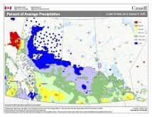
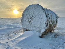
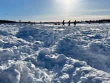
A lot of the weather talk in January was about precipitation — in particular, just how much snow seemed to have fallen. When we look at the data, both the Brandon and Dauphin regions did report well-above-average snowfall. Brandon reported about 36 mm of water-equivalent snowfall, which is about double the January average. Dauphin was not far behind with 29 mm, which was also about double the average. Winnipeg officially reported 20 mm, which was right around average. I say “officially” since several personal weather stations that I know of around the city reported amounts in the 25- to 30-mm range. As for the number of snowfalls during the month, all three locations reported around 14 days with measurable snow. This is a little above the average of 11 days.
Measuring snowfall can be difficult under ideal conditions, but this January, conditions were less than ideal due to all the wind. Looking back, the data does support the notion that it was a windy January. While Environment Canada does not report average wind speeds, it does report peak wind speeds. Over the month, most regions reported between eight and 10 days with peak wind speeds at or above 55 km/h.
While January was a cold month compared to average, there were warm days, with both Brandon and Dauphin recording above-freezing temperatures at least once and Winnipeg coming in just shy of the freezing point.
Updated outlooks
To summarize, January 2022 was colder and wetter than average. Normally at this point we would look back to see which long-range forecast was the closest, but due to the holidays I was not able to create an outlook for January. While I know we just looked at the long-range forecasts for the rest of winter and early spring a couple of issues ago, most of them have been updated, so here is a look to see if anything has changed.
Starting off with the almanacs, since they publish their outlooks all at once, nothing has changed. The Canadian Farmers’ Almanac looks to be calling for cold weather in February and possibly March and April, along with above-average precipitation, as it mentions snow, stormy and wet weather fairly often. The Old Farmer’s Almanac is calling for warm weather from February right through to May. Its precipitation forecast is for near- to slightly below-average amounts from February to April, with well-above-average amounts in May.
Moving on to the computer models: NOAA’s forecast is also still the same and calls for both near-average temperatures and precipitation from February right through to May. Actually, its forecast calls for equal chances of either being above or below average for both temperature and precipitation. Its precipitation forecast calls for near- to above-average amounts in all four months.
The CFS model has changed its outlook a little bit; its latest forecast predicts near-average temperatures in February and March followed by below-average temperatures in April and near average in May. This model also calls for near- to above-average precipitation in February, March and May with near-average amounts in April.
Looking at the Canadian model or CanSIPS model, it continues to call for below-average temperatures for all four months along with near- to above-average precipitation.
Lastly, my forecast. I am going to stick with my gut instinct and stay with the prediction of near- to slightly below-average temperatures along with near- to slightly above-average precipitation across all four months. I also think we will continue to see big swings between very warm and very cold temperatures.

