It’s starting to look more and more like we’re heading back into the weather pattern that has dominated our weather for most of this year: cool and unstable.
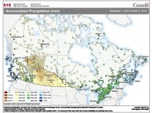
Last week’s forecast played out fairly well, with the only fly in the ointment being the persistent cloud cover that stuck around early this week instead of sunny skies. It looks like cloud cover with the chance of showers will be the weather for much of this forecast period, as we remain in a fairly active weather pattern.
Read Also

Thunderstorms and straight-line winds
Straight-line winds in thunderstorms can cause as much damage as a tornado and are next on our weather school list exploring how and why severe summer weather forms.
An extremely large area of low pressure will be parked over much of Eastern Canada during a good part of this forecast period. This will keep our forecast region under a predominantly northerly to northwesterly flow. Along with temperatures on the cool side we will see plenty of clouds and showers, as pieces of energy rotate around the main area of low pressure.
The coldest readings look to move in late over the long weekend, as the eastern low slowly pulls away and arctic high pressure begins to move in. I won’t be surprised to see some snow flurries over the weekend as temperatures hover only a few degrees above freezing. The only bit of good news is that with the cloud cover overnight, lows will not be too cold.
The weather models were leaning toward a return to milder weather by the middle of next week, but they are now pulling back on that forecast. Instead they are now calling for the cool and unsettled weather to continue.
Usual temperature range for this period: Highs: 7 to 18C. Lows: -4 to 6C.
Probability of precipitation falling as snow: 20 per cent.