The weather page is prepared by Daniel Bezte. Dan has a BA Honours degree in geography, specializing in climatology, from the U of W. He has taught climate and weather classes at the U of W, and is a guest climate expert on CJOB’s morning show with Larry Updike. Daniel runs a computerized weather station on his 10 acres near Birds Hill Park, which he plans to develop into a small vegetable and fruit hobby farm.
Daniel welcomes questions and comments at [email protected]
Read Also

June brings drought relief to western Prairies
Farmers on the Canadian Prairies saw more rain in June than they did earlier in the 2025 growing season
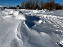
The models are starting to point towards some cold weather moving in. The question is, will we see any significant snow before we head into the deep freeze?
The overall pattern is not changing a lot, we are still in a basically northwest flow and this is where our weather systems will be coming from. Three different storm systems are currently being forecasted by the weather models to move through our region over the next seven to 10 days.
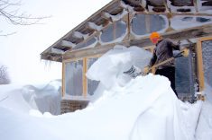
The first of these systems will move through early in the weekend bringing a slight chance for some snow. This system does not look like it will be very strong. A second, and slightly stronger system, could move in late in the weekend bringing a better chance of some measurable snow. Finally a third storm system could move through western parts of Manitoba during the first half of next week. None of these systems currently look like they will be terribly strong, but they all have some potential to bring some stormy weather to parts of our region.
Behind the final system the models are showing an outbreak of arctic air which will likely usher in the coldest weather of the season so far. Overnight lows could fall into the -30C range as Arctic high pressure settles over the region later next week.
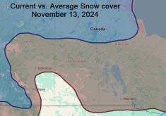
Usual temperature range for this period: Highs: -17 to -1C Lows: -27 to -10C