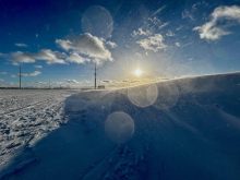
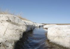
I have been accused of it, but I am not a weather sorcerer! Yes, I talked about the history of big spring snowstorms, and delayed talk about lack of snow cover this winter, but that doesn’t mean I had anything to do with the snowy conditions across much of the Prairies in recent weeks.
The global temperature summary for February just came out, and it appears our planet is still running a temperature, as we witnessed across the Prairies last month.
According to the Copernicus Climate Change Service, last month was the warmest February on record globally. Here are the highlights from that report:
Read Also
Why is the sky blue?
The colour of the skies, on the Prairies and elsewhere, tells the story of the paths sunlight takes as it enters Earth’s atmosphere, Daniel Bezte writes.
- February 2024 had an average surface air temperature of 13.54 C, 0.81 C above the 1991-2020 average for February and 0.12 C above the temperature of the previous warmest February in 2016.
- This is the ninth consecutive month that was the warmest on record for the respective month of the year.
- The month was 1.77 C warmer than an estimate of the February average for 1850-1900, the designated pre-industrial reference period.
- The global average temperature for the past 12 months (March 2023–February 2024) is the highest on record, at 0.68 C above the 1991-2020 average and 1.56 C above the 1850-1900 pre-industrial average.
- The daily global average temperature was exceptionally high during the first half of the month, reaching 2 C above the 1850-1900 levels on four consecutive days (Feb. 8-11).
- Temperatures were above average over Europe, northern Siberia, central and northwest North America, most of South America, across Africa, and in western Australia.
- El Niño continued to weaken in the equatorial Pacific, but marine air temperatures in general remained at unusually high levels.
- The average global sea surface temperature for February over 60°S – 60°N was 21.06 C, the highest for any month in the dataset, and above the previous record of August 2023 (20.98 C).
- The average daily sea surface temperature reached a new absolute high of 21.09 C at the end of the month.
It appears there is still a lot of extra heat in the system, so even though El Niño is weakening and looks to become neutral or even shift into a La Nina by fall, 2024 has the potential to break last year’s record for warmest year on record globally.
Now let’s look at snow cover. I looked at data from two major reporting centres in each province. In Manitoba, it was Winnipeg and Brandon, in Saskatchewan it was Regina and Saskatoon, and in Alberta it was Calgary and Edmonton. I looked at monthly data from Environment Canada, which can be a little iffy at times, and determined the following measurements:
- Number of days with snow on the ground with a trace of more snow.
- Deepest snow cover for any day during the month in centimetres.
- Average snow cover for the month in centimetres.
- Percent of average snow cover using data from 1981-2010.
As expected, snow cover across the Prairies was well below average except for Calgary. In November, Regina was the snowy spot with every day reporting some snow on the ground. Even so, snow cover was light at 67 per cent of average. Saskatoon and Edmonton battled it out as the least snowy spot. Both reported an average depth of snow cover at 0.
Lack of snow cover continued into December in Saskatoon, with an average of 0 cm. Regina, Winnipeg, and Brandon also saw little snow cover in December at about 11 per cent of average. Calgary was the snowiest spot, at least compared to average, at 75 per cent of average.
In January, Regina saw a measly one cm, only six per cent of average. Calgary continued to have the most snow cover compared to average, at six cm, which was 150 per cent of average. Overall, southern Manitoba had the most snow cover. Both centres reported snow cover on every day of the month and the largest average snow cover at seven cm, which was 40 per cent of average.
It was an interesting snow cover story in February, especially across Saskatchewan. Regina reported no snowfall or days with snow cover. It received precipitation, but any that fell did so on days above zero. Saskatoon had a much snowier month with the largest single day snow cover of 16 cm, along with largest monthly average of 5.5 cm., which was 66 per cent of average.
Winnipeg, Brandon and Calgary all reported snow cover for every day of February. Calgary once again had the greatest snow cover compared to average, at 117 per cent.
March’s numbers only go to March 6, but the month had a snowy start except in Regina. Before March, the deepest one-day total was 15 cm. After the first week of the month all stations except Regina exceeded this value, with Saskatoon reporting a respectable 39 cm.


