I have received several weather-related questions to answer. The first is about the flooding rains and heavy snow that California has received over the last three weeks. In particular, what is an atmospheric river?
The second question is, why have we been so cloudy lately, especially since we are not seeing much snow and our weather has been mostly dominated by high pressure. Shouldn’t it be sunny?
Let’s start with the series of flooding storm systems that have battered California since Boxing Day. After several years of intense drought, California is finally getting some much-needed moisture in the form of heavy rains and mountain snows.
Read Also
VIDEO: What climate change data gets wrong about the Prairies
Precipitation, not temperature, may be a better gauge of climate change impact on the Prairies, says director of the Prairie Adaptation Research Collaborative.
As with many things, you can have too much of a good thing. While the rains help fill record-low reservoirs, those reservoirs are still only approaching “normal” levels and have a long way to go to reach capacity. I put “normal” in quotes because, in certain situations, the term doesn’t describe a situation.
When it comes to the weather, we rarely see normal or average conditions. We are usually either above or below the average. This is why I like to use a temperature range when we look at how hot or cold it has been or will be.
We get averages by combining all the data on a specific type of event over a period of time, then dividing by the number of measurements we added. When studying weather or climate, the time frame used to create averages can be minutes, days, months, years, centuries or even millennia. So, what’s average – or whether current conditions are average – depends on the selected time frame.
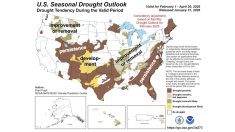
For the last number of years, California has been in a severe drought with well-below-average precipitation. Let’s say this current wet period continues, resulting in above-average precipitation. Combine these time periods together and it may turn out to be average.
Back in my university days, we looked at this topic and discovered periods of below-average weather conditions are usually followed by above-average and vice-versa. This means, over time, our weather tends to average itself out – thus the term “average,” right?
When we talk about climate change, we are looking at the relatively slow slide of the average and just how far to the extremes we are going. The whole idea is that periods of excess weather in any one direction will usually be balanced or averaged by a period of excess weather in the other direction. In California’s case, drought followed by excess rain.
Moisture channels
What is an atmospheric river? This term falls into the same category as the polar vortex. The two have always been around, but lately it seems like the news grabs hold of terms and make it seem like a new phenomenon. They’re not. They’ve been around for probably as long as weather has been happening on this planet.
Basically, an atmospheric river is a channel or stream of air that has a high amount of water vapour compared to the air around it. We see this happen in our part of the world when we get a flow of air coming up from the gulf stream.
The difference with our gulf stream moisture and the atmospheric rivers is that the latter tend to be narrower. In California’s case, these rivers or channels of moist air get pulled from the tropical Pacific, then hit its coast and mountains, forcing the air to rise and dump its load of moisture. Since it is a continual stream, the moisture coming ashore keeps getting replenished, resulting in large rain and snowfall totals.
The second question I received was, why have we been so cloudy even though our weather has been mostly dominated by high pressure? Doesn’t high pressure equal clear skies?
My answer is yes, high pressure usually brings clear skies. A simple definition of high pressure is that it is an area of sinking air. Sinking air usually does not allow for cloud formation because it warms as it gets compressed.
Sometimes this sinking air does not make it all the way to the ground. Instead, it forms a sort of lid on the lower atmosphere. This lid, like on a pot, traps the air underneath it. This trapped air, especially in the winter, will cool as heat is lost to space, but the sinking air above the trapped layer is heating up due to compression. This creates a layer of warm air over an area of cold air, resulting in a rather stable atmosphere.
So, if it is stable, why all the clouds, fog and light flurries?
Well, that same lid also traps the moisture in the lower layer, allowing it to slowly build. Sunshine provides a little bit of heat to the lower layer, allowing the air to rise toward the lid. As it rises, it cools, and clouds form or fog develops, but since it is a stable atmosphere, there is nothing to keep the process going, so no significant precipitation forms.
The atmosphere is stable. It has a lid due the sinking air above, and we see little wind, meaning there is nothing to break up the low clouds. The only way to end this type of weather is for the main storm track to move back into our region, bringing low pressure and higher winds, or stronger arctic high pressure that forces out this low-level trapped air.
Either way, we would end up losing the nice, mild, picturesque weather we’ve seen for much of January.


