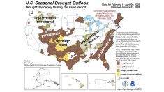
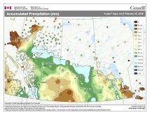
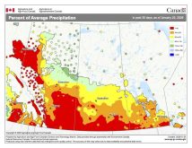
The weather models have been on a bit of a roll lately as last week’s forecast once again played out close to what was predicted. We saw an abrupt return to cold weather, followed by a quick weekend warm-up, then followed by a return to colder conditions. The main storm track stayed either well to our north or south, keeping southern and central Manitoba relatively dry. This led to the most asked question over the last couple of weeks: are we going to see more snow this winter?
To start to answer that, let’s dig into what the weather models predict for this forecast period. It looks like we’ll start this period with a battle developing between a large area of low pressure developing over the west-central U.S. and a large area of arctic high pressure building southward out of the Yukon. It currently looks like the ridge of arctic high pressure will win out across our region, keeping the low to our south, which will result in some heavy snows over the northern states. For us, this means sunny to maybe partly cloudy skies with temperatures on the cool side. Expect daytime highs to start off around -15 C but slowly fall into the -20 C range by the weekend. It may be a little windy on Wednesday and Thursday as the low passes by to the south, but winds should become light by Friday as the centre of the arctic air passes over us.
Once this high slides by to our southeast late in the weekend, we should see a westerly to southwesterly flow develop. This will help temperatures to slowly moderate, with daytime highs by Monday or Tuesday (Feb. 27-28) warming back into the -10 to -15 C range. We may see the odd flurry during this period as a couple of weak disturbances ripple through our region, but beside the strong low forecasted for early in the forecast period, the weather models aren’t showing any significant storm systems in our region right into the first part of March.
Read Also
Forecasting spring 2026 weather on the Prairies
What weather can farmers expect across Manitoba, Alberta and Saskatchewan as they head into seeding? Plus: a lesson on what makes the seasons turn
Usual temperature range for this period: highs, -16 to -3 C; lows, -30 to -10 C.


