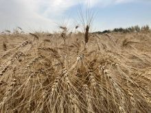
(Resource News International) — The harvest window for western Canadian farmers bringing in the last of this year’s crops will remain open until at least mid-October and possibly longer according to meteorologist Drew Lerner, president of World Weather Inc. in Kansas City.
“I think we’ll be able to get through a fairly good chunk of October, at least the first half of the month,” said Lerner. “It wouldn’t surprise me if we get all the way through October without a return of ‘the big wet’ that we had before,” he added.
Read Also

USDA attachés forecast some changes in China’s oilseeds, cereals
As China heads into the 2026/27 marketing year, the United States Department of Agriculture attachés in Beijing projected a few minor to moderate changes in the country’s soybean, canola, corn and wheat crops.
“We should be unseasonably warm this week, going into the weekend,” said Lerner.
Temperatures, he said, were forecast to turn cooler in the second week of October, but there will only be a few weak disturbances bringing precipitation during that timeframe.
Any rainfall will be light, he said, and will not delay harvest operations to any large extent.
While frost could come with the cooler temperatures in the second week of October, most areas have already seen a hard freeze lessening any potential damage to the crops, said Lerner.
Environment Canada is currently forecasting daytime highs across Western Canada in the teens to mid-20s Celsius through Oct. 10, with the only precipitation in Alberta and northern Saskatchewan dissipating by Tuesday (Oct. 5).