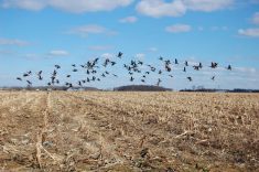
CNS Canada –– Cooler temperatures and precipitation are on their way for parts of the Prairies this week, but producers have little to worry about as weather specialists say it won’t hang around long enough to damage crops.
“There’s a storm system for Friday and Saturday (August 22 and 23) which looks a little ominous at the moment,” said Drew Lerner, president of World Weather Inc. in Kansas City. “I think there’s still a potential for the system to weaken quite a bit, but it’s still going to produce generalized rain.”
Read Also

Feed Grains Weekly: Cash prices for wheat, barley largely flat
Cash prices for feed barley and wheat continued to remain largely flat, said Susanne Leclerc of Market Master Ltd. in Edmonton.
Lerner said he expects the storm system will probably produce 20 to 60 millimetres of rain in the eastern Prairies. There will also be lighter, more erratic rainfall leading up to the heavier weekend rains, followed by cooler, drier weather early next week.
“The eastern Prairies will probably have a shot of cold coming up here late this weekend and into early next week,” said Lerner. “But it won’t be cold enough to push us over the edge and cause any crop-threatening environment.”
There will be more precipitation in the longer-term, following the cooler, dry weather in the short term.
“Next week will probably be a little bit drier and that’s why we’ve got that cooler shot of air that will be of interest, (and) it will probably rattle a few cages during the early part of next week,” said Lerner. “But the dry weather will probably only be short-lived and it will go back into another round of wetter-biased conditions, especially when we get into September.”
Field work will have to advance around the rainfall, he said, advising that producers shouldn’t wait for perfect weather conditions for harvest this year.
“They should keep close tabs on the timing of these weather systems so that they can get into the fields as quickly as they can, so they can avoid any kind of quality issue,” he said.
Manitoba, eastern Saskatchewan and the northern U.S. Plains are expected to see slightly warmer than normal temperatures for the last portion of August and into early September. Lerner said he would be more concerned with northern Alberta later on this month or in early September.
“If anybody is going to be vulnerable to a normal or slightly earlier than normal frost-freeze event it’s going to be that area,” said Lerner.
“Northern parts of Alberta and maybe the far northwest corn of Saskatchewan (will be vulnerable to early frost), but for the most part the Prairies are going to be normal to later than normal on their first frost-freeze event.”
— Marney Blunt writes for Commodity News Service Canada, a Winnipeg company specializing in grain and commodity market reporting.