Holy cow, it’s hard to believe we are into the last month of 2022.
From a climatological point of view, we have just finished the first full month of winter across the Prairies. For those who are more astronomical, we are now entering the first full month of winter.
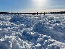
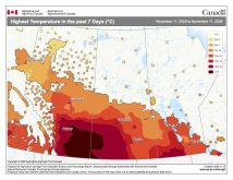
No matter which way you view it, November across the Prairies can run the gamut of weather from summer-like conditions to the deep freeze of winter. Unfortunately, for most places this November, winter-like conditions mostly won out, but how much?
Read Also

Prairie weather all starts with the sun
The sun’s radiation comes to us in many forms, some of which are harmful to organic life while others are completely harmless or even essential, Daniel Bezte writes.
Before we dive into this topic, let’s take a quick look at what has been happening over the Arctic and Antarctic oceans.
Around Antarctica, the amount of November sea ice was the fourth lowest since accurate satellite readings began. Ice extent has been declining rapidly and was at or near record lows by the end of the month.
Over the Arctic Ocean, sea ice extent for November was the eighth-lowest on record. Ice growth was below average early in November but increased rapidly by the end of the month as excess oceanic heat was released to the atmosphere.
Now, on to the monthly weather review and our look ahead to see what the weather models say about what to expect over the next two months.
Starting in Alberta, after one of the warmest summers and falls on record across most of that province, November took a bit of a turn for the worse. After five consecutive months of well-above-average temperatures, readings across all three of the main reporting sites (Calgary, Edmonton and Peace River) came in below average.
[RELATED] Province reminds snowmobile riders of winter rules
The Calgary region was coldest relative to average, with a mean monthly temperature of -5.7 C, which was more than 3 C below average. In the Edmonton region the mean monthly temperature was only a little colder at -6.1 C, but thanks to its more northerly location, this reading was only around 1.0 C colder than average. Peace River was the cold spot, with a mean November temperature of -8.5 C, though this was only about 0.7 C below average.
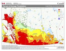
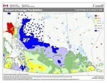
Precipitation in Alberta was mostly above average, as at least three major storm systems impacted a large portion of the province.
When all the precipitation or snow was added up, Calgary was the wettest spot, with 35.2 mm of melted snow, which was nearly triple their monthly average. Edmonton reported about 27 mm, which was about 10 mm above average. The Peace River region missed out on most of the big storms and received only about eight mm of water-equivalent snowfall, which was well below their average of 24 mm.
Moving into Saskatchewan, the colder-than-average temperatures continued. Regina reported a mean monthly temperature of around -8 C, with Saskatoon coming in around -9 C. Both readings were around 2.5 C below their respective long-term averages. Precipitation for the month was near average in both locations.
Southern and central Manitoba missed out on the really cold weather in November. The Winnipeg region came in about 0.5 C above average, the Brandon region about 0.5 C below average, and the Dauphin region reported right around average temperatures.
While it was an average month temperature-wise across agricultural Manitoba, precipitation was on the light side, with both the Winnipeg and Brandon regions reporting around 10 mm of water-equivalent precipitation, which is about 50 per cent of average. Dauphin saw around 20 mm, which was average for that region.
Overall, the western Prairies saw colder- and wetter-than-average conditions in November. The central Prairies were colder than average with near-average precipitation, while the eastern Prairies saw near-average temperatures and below-average precipitation.
Looking at the forecasts made at the end of October, I would give the win to the Canadian Farmers’ Almanac as it predicted a colder-than-average month with above-average precipitation, especially over western regions.
Now to the latest long-range weather models. The Old Farmer’s Almanac is calling for December to February to be colder and snowier than average. The Canadian Farmers’ Almanac is calling for near-average temperatures in December and February with below-average temperatures in January. It looks like all three months will see above-average precipitation, with the mention of stormy weather a couple of times each month.
Moving onto the computer models, NOAA’s monthly forecast calls for below-average temperatures and above-average snowfall, with the greatest chance for above-average snowfall over Alberta.
The ECMWF model is calling for near-average temperatures across southern regions, cooling to below average as we move northward. Precipitation is expected to be near average over eastern regions and above average in the west.
The CFS model is calling for a similar precipitation pattern as the ECMWF model but predicts below-average temperatures across all three provinces. The CanSIPS or Canadian model is calling for a continuation of November temperatures, with eastern regions seeing near-average temperatures and western regions seeing below-average temperatures. Precipitation is forecasted to be near average across all regions.
That leaves my prediction, and to tell the truth, I have no real idea. Whenever this happens, I have to go with my gut and it is leaning toward colder-than-average temperatures across western regions with near-average temperatures in the east. I am also going for near- to slightly above-average snowfall across all regions, with the best chances for above average snowfall over western regions.
Now, as usual, it is time to sit back and watch Mother Nature make fun of all our attempts to do long-range weather forecasting.

