Hopefully you read last week’s weather article and have been attempting to make a few weather forecasts of your own. Some of you might wonder why last week’s article wasn’t all about the snowstorm that affected much of southern and central Manitoba. It has to do with deadlines; due to Remembrance Day I had an early deadline last week, which meant my weather article was sent in before the storm really got going.
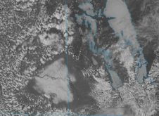
Overall the weather models were correct in forecasting what has been called a hybrid Colorado low. In fact, they did an amazing job at predicting the storm over a week in advance. What the weather models had a harder time predicting was exactly where most of the snow was going to fall. Right up to the middle of the storm, the weather models were sticking to their guns and predicting that the majority of the snow would fall over the Red River Valley, with estimates running upwards of 40 to 50 centimetres. While the models ended up being right on the money for the amount of heaviest snow, they were a little too far south and east. If you look at this week’s weather map you can see areas north and northwest of Portage la Prairie received the greatest amount of snow.
Read Also

June brings drought relief to western Prairies
Farmers on the Canadian Prairies saw more rain in June than they did earlier in the 2025 growing season
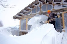
Overall, nearly all regions saw at least 15 cm of snow from this storm system, with a large portion of our region seeing over 20 cm. The highest totals from the storm were recorded north of Swan River, in the Mafeking region, where upward of 60 to 80 cm of snow was reported.
There were a couple of unusual things about this storm system. The first was a lack of really cold air for the storm system to work with. Usually, this strong of a storm at this time of the year will tap into cold air over northern Canada. While the storm is occurring, temperatures may not get that cold, but the days following a large storm like this will usually see very cold temperatures move in. Back in November 1986, in the days following the Nov. 8 snowstorm, temperatures across southern and central Manitoba bottomed out in the mid -20 C range, with some record-low temperatures recorded. In the days following this year’s storm, temperatures did cool off, but it took a bit of time and we only saw a couple of nights with lows approaching -20 C in some areas.
In reality, it was the lack of any significant cold air that kept this storm as just that: a storm, not a blizzard. If there was more cold air available for this storm, I believe things would have been much worse and we would have likely seen record amounts of snow over a much larger region. This brings me to the second unusual thing about this storm: just how much snow did fall, given the fact that all the typical weather elements didn’t really come together to make this a really big snow-producing storm?
I’ve done some number crunching on winter snowfall across southern Manitoba and I thought I would share these with you as it will help to put this snowstorm into some kind of context.
Looking at Winnipeg’s snowfall data from the years 1873 to 1991 I calculated the probability of how many snowfall events will occur over an average winter. A snowfall event is any day or days where snowfall is recorded. If snow falls on one day, it would be a snowfall event; if snow falls on two or three consecutive days, that would also be seen as a snowfall event. In a typical winter, the Winnipeg region can pretty much expect to have a minimum of 10 snowfall events. On average, this region can expect to see around 28 snow events during a winter; the record number of snow events is 38, which occurred back in the 1930s.
How much snow would this region typically expect to see during any of these snowfall events? Not surprisingly, for the majority of these events, we only receive one centimetre or less. This tells us that most of our snow comes from just a couple of big or heavy snow events each winter — and when you think about it, that’s what usually happens. The chance of seeing 10 cm of snow during a snow event is about 10 per cent. This means in a typical winter we would see this amount of snow fall about three times. If we bump up the amount of snow to 20 cm, the probability drops down to only around two per cent. This means we would typically see a 20-cm snow event about once every two years. A 30-cm snow event has a probability of around 0.5 per cent, which converts into seeing this much snow fall about once every seven years. Finally, the probability of receiving 40 cm of snow during a snowfall event is only 0.1 per cent, which converts into once every 35 years.
From this we can see that for some regions, this snowstorm was not that unusual, while for others it was the type of snow event one might see only a couple of times in a lifetime.