For this article, it’s time to get back to weather school, where we’ll take a closer look at just why we are subject to chaotic storm systems that make forecasting our weather a real challenge, especially in the fall and springtime. Before we dig our way into this topic, here’s a quick look at September’s global temperatures.
Globally, September was another hot month, with two of the four main reporting bodies reporting in so far. According to the European Copernicus Climate Change Service, September 2020 was the warmest September on record, eclipsing last September by 0.05 C. Meanwhile, the University of Alabama in Huntsville reported the warmest global land temperatures in its 42 years of record. Next issue, both NOAA and NASA should also be out with their numbers, which should come in very similar to these.
Read Also
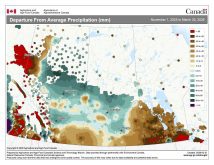
VIDEO: Here’s Manitoba’s 2026 spring storm forecast
Weather models are calling for above-average precipitation in southern Manitoba, with at least two more Alberta clippers possible.
Causes and effects
OK — on to just why our weather can be so hard to predict, but sometimes why it is also so fun to live in and talk about. To begin with, we’ll take a big-picture look at what causes the weather in our region. Then we’ll focus in on the various combinations and permutations of weather and landforms that help create the daily weather we all experience. Let’s just say that while we live in one of the most dynamic weather regions of the world, it also means we live in one of the most difficult-to-understand regions as well!
I always feel that to best understand a particular topic, you need to have a general overview to help put things into context. So far, we have come to an understanding that over the poles of our planet the air is generally cold. Cold air is heavy and therefore sinks, and sinking air creates high pressure. The regions around the poles of our planet are generally regions of high pressure. This sinking air needs to spread out when it hits the ground and the only direction it has to go is toward the equator. As the air at the North Pole travels south, the Coriolis force deflects it to the right. So now our southward winds are blowing easterly, resulting in the polar regions having prevailing winds from the east. I know some people don’t believe this, but it is true.
To our south we have our subtropical high where air is also moving downward, but this time because it’s being forced to do so. This forcing of the air downward creates a region of high pressure that is warm and dry. When this air hits the ground, it too is forced to spread out; however, for this area, the air can either flow southward, back toward the equator, or northward, toward the poles. The air that flows northward will also be deflected to the right due to the Coriolis force. This deflection results in these southerly winds becoming westerly, giving our region of the world our predominantly westerly winds. Since we live in this region, most of us have no problem believing this.
OK — we now understand why we have the general winds we have. Now let’s start to examine what happens with these winds that gives rise to our stormy and hard-to-predict weather.
The first thing we need to look at is the area around the globe where the regions of northeasterly winds meet up with the westerly winds. Our atmosphere behaves very much like a fluid so maybe I will try a water analogy here to try to create a picture of what happens. I think everyone over the course of their lives has watched water flowing in some form or another. Often water is flowing in just one direction, but every so often we see water flowing from one direction meet up with water from another direction (just watch spring run-off flowing from culverts to see this). If you’ve seen this, you have an idea of what happens.
You will often see the water from one direction flowing past the water coming from another direction. If our flow is strong enough it will be easy to see what I’m going to talk about, but if the flow is weak then you must look closely to see. Some of you already know I’m talking about eddies — that’s right, those little (or sometimes big) swirls of water. To get eddies to form we either need water flowing in different directions or some kind of object in the way of the flowing water to induce spin.
Well, guess what? The atmosphere behaves in pretty much the same way. Along the region where the northeasterly winds meet up with the westerly winds, eddies will form. Sometimes they will be weak and not last long, while other times they will be very big and strong and last for a long time. Also, atmospheric eddies are not all the same. Some will be cold, and some will be warm, depending on how the air is mixing, but they will almost always end up creating stormy weather.
Well, we will have to end it there for this lesson as I am running out of room. We now have the big picture on what helps to create the areas of low pressure that so strongly influence our weather, but so far, we have only just scratched the surface. Just like the eddies in a stream, there are numerous reasons why they form, and just because one forms at one time doesn’t mean another one will form there again, but I digress — more on that next time.