I keep promising to take a final look at this year’s frost data, but here we are at the end of another month.
Though there are a couple days left in October as I write this, by the time you read it we will already be a couple of days into November. If I wait one more week to get final October weather data, it will push our monthly weather review and long-range forecasts into the middle of November, and that just won’t do.
Luckily, the weather looks to be stable for the last two days of October, which lets me extrapolate data to the end of the month.
Read Also
How Earth evens out the energy input
Earth has surpluses of radiation in its equatorial regions, and deficits toward its poles. Our weather is a matter of Earth trying to even out the imbalance, Daniel Bezte writes.
Let’s begin our look at October’s weather in Alberta. Across this region, a persistent ridge of high pressure that brought very warm temperatures in September continued into October, and if anything, intensified. Alberta saw mean monthly temperatures that ranged from around 7 C in the Peace River region to around 10 C in both the Edmonton and Calgary regions.
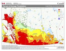
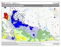
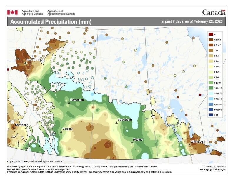
These temperatures were a good 4 to 6 C above the long-term averages. Precipitation in October was well below average in most northern and central regions, with areas in the south seeing near- to above-average amounts.
[RELATED] Cold, snowy start seen to Prairies’ winter
Moving to Saskatchewan, it also saw continued warm September weather. Most regions reported mean monthly temperatures between 6 and 7 C, which was 3 to 4 C above average. Like Alberta, more northern regions saw below-average rainfall, while areas in the south saw near- to above-average amounts thanks to a late October snowstorm.
In Manitoba, we did not have the consistent impact of the upper-level ridge that brought all the high temperatures to our western neighbours. That said, when all the numbers are added, our region did experience above-average October temperatures.
Mean monthly temperatures across all three regions of the province were remarkably similar, ranging from around 6 C in Brandon to about 6.5 C in both Winnipeg and Dauphin. These temperatures were about 1.5 to 2 C above October’s long-term average.
Total October precipitation played out a little differently than our western neighbours. Most of the precipitation in October fell from the Colorado low that tracked through around Oct. 24. This low brought two areas of precipitation, one through southern Saskatchewan and the other through south-central Manitoba. Western parts of Manitoba missed the heavier amounts, with both Brandon and Dauphin regions reporting below-average precipitation for the month.
In Winnipeg, thunderstorms from the Colorado low brought enough rain to not only push October’s precipitation total into the above-average category, but also set an all-time record for wettest year – and there are still two months to go!
Overall, across the Prairies, October was a warmer and a mostly drier than average month. Which forecast did the best at predicting October’s warm and dry weather pattern? I would have to give the win to the CFS and the ECMWF weather models with their predictions for above-average temperatures and near- to below-average precipitation.
Now to the question that is on nearly everyone’s mind. Just how cold and snowy is the first half of winter going to be? The Old Farmer’s Almanac is calling for near-average temperatures from November through to January. Precipitation is predicted to be near average in November and slowly climb to above average toward January.
The Canadian Farmers’ Almanac is calling for a cooler than average November and December. January will start off cold, but it mentions warming toward the end of the month. It looks like it will be a wet or snowy start to winter as it mentions snow, heavy snow and storms several times in all three months.
Looking at the weather models, starting off with NOAA, its latest long-range prediction still calls for near-average temperatures across all three months with near-average precipitation over the eastern Prairies and above-average amounts over western regions.
Next up is the European or ECMWF model and it is predicting near- to maybe slightly above-average temperatures in all three months with near-average precipitation across extreme southern parts of the Prairies, transitioning to above or well above average amounts as you go north.
Next is the American CFS model. It predicts above-average temperatures in November, becoming colder than average in both December and January. Its precipitation forecast is for near-average amounts in November and January and above-average amounts in December. Our final weather model, Canada’s CanSIPS, predicts a rollercoaster ride with near-average temperatures in November, above average in December, then below average in January. Precipitation is predicted to be near average across all three months.
My gut or intuition is leaning toward the CFS model, but maybe that is just because it would mean lots of snow in time for the Christmas holiday season and I want to test my new snow blower.
With lots of variation in predictions, I guess there is hope for everyone to get what they want.


