The first month of summer has come and gone.
For some regions it was a perfect month weather-wise, while for other regions it was a bit of struggle due mostly to the lack of rainfall.
The last time we looked at the monthly data I was hoping that we would see a shift towards wetter weather. If you look at this issue’s map, you will see that for some regions the weather did exactly that.
Read Also
VIDEO: What climate change data gets wrong about the Prairies
Precipitation, not temperature, may be a better gauge of climate change impact on the Prairies, says director of the Prairie Adaptation Research Collaborative.
While it was wetter in some regions, we will see when we look at the data, at least for the major reporting centres, it was not an overly wet month.
Let’s look at the data, from the main reporting centres in each province, followed by a look at how those actual temperatures compare to average. We will then follow that up with a look at precipitation rankings and how they compare to average.


Looking at June’s temperatures, it was an average month across the Prairies, with the exception of Winnipeg and Calgary which saw above average temperatures. I say this as anything within plus or minus 0.5 C is around average.
By raw numbers, the warmest province was Manitoba and the coldest Alberta, which is often the case in the summer. Looking at temperatures compared to average, then Saskatchewan was the cool spot with both Regina and Saskatoon coming in 0.4 C below average.
For precipitation, the numbers tell a story of just how dry some regions have been but also show that for the first time in a few months some locations came in slightly above average.


Looking at the tables, you can see it was a relatively wet month in Calgary, Edmonton and Saskatoon, with all three locations reporting above average amounts. Manitoba was once again the dry spot with Brandon and Winnipeg coming in last both in terms of absolute rainfall and difference from average. For the Winnipeg region, they are now at a yearly precipitation deficit of over 140 mm which is the highest amount amongst the main reporting stations.
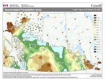
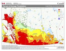
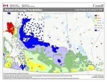
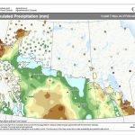
Overall temperatures across the Prairies were near average in June with precipitation ranging from near to above average across the central parts of Alberta and Saskatchewan, to well below average over southern Saskatchewan and Manitoba along with northwestern Alberta.
Looking back at the different weather predictions, while none were 100 per cent correct, I have to give the win to the CFS model, from the U.S. National Centers for Environmental Prediction.
It predicted warmer than average temperatures over the eastern Prairies with near average temperatures over western regions. It also predicted near to above average precipitation over north-central Saskatchewan and central Alberta. Where is was off was it also predicted well above-average precipitation over southern Manitoba.

Forecasts
Now on the latest long-range forecasts or predictions. As we do every month, we will start off with the almanacs. Since their forecasts come out once a year, they don’t change from month to month, so this is simply a reminder of what they are predicting.
The Old Farmer’s Almanac is calling for near average temperatures in July and below average in August. Their precipitation forecast is calling for above average amounts in both July and August.
The Canadian Farmers Almanac seems to be leaning towards a hot and dry July with the last month of the summer seeing near to above average temperatures with near average precipitation.
Moving on the different weather models. NOAA’s forecast, extrapolating northwards, looks to be calling for slightly above average temperature across the eastern Prairies this summer with the western Prairies seeing above average to well above average temperatures in July and August. NOAA’s precipitation forecast is still calling for below average amounts all summer long with the driest conditions expected to be across the southern Prairies.
The CFS model is currently calling for near to above average temperatures right across the Prairies in both July and August with the western Prairies seeing the best chance of well above average temperatures. Their precipitation forecast is for near to below average amounts across most regions with a few spotty regions seeing above average amounts.
Next is the good old Canadian CanSIPS model. Their latest model run shows Manitoba seeing near to even below average temperatures in both July and August, with Saskatchewan seeing near to slightly above average temperatures and Alberta experiencing above to well above average temperatures. Their precipitation forecast is pretty straightforward, below average amounts across all three Prairie provinces in both July and August.
Last on our list of computer models is the European ECMWF, which has not changed its tune from last month and is predicting well above average temperatures in July and August. Their precipitation forecast is calling for most regions to experience below average amounts in July with August coming in with near to below average amounts.
Finally, my take — this time around I am a little unsure. I am going to lean towards near to above average temperatures, with most regions seeing below average precipitation.
In the next issue we will continue our look at severe summer weather, this time examining what is probably the most awe-inspiring weather event and also the most frightening — tornadoes.


