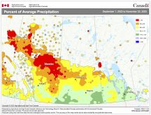
The forecast for the next seven to 14 days is going to disappoint those who are wishing for an early start to winter. The two dominant weather features during this forecast period will be high pressure to our south and southeast and strong low pressure to our northwest over the Gulf of Alaska.
The combination of these two features will pretty much ensure that our warm, dry November weather will continue for a while yet. The large area of low pressure over the Gulf of Alaska is controlling the flow of energy off the Pacific Ocean. All the energy is being push into northern North America and any energy that makes it over the mountains has very little moisture left.
Read Also

June brings drought relief to western Prairies
Farmers on the Canadian Prairies saw more rain in June than they did earlier in the 2025 growing season
While we are only on the edge of the ridge of high pressure to our south, it is providing us with more sun than clouds and when it does build a little northward we see really mild temperatures. The only downside to this setup are the winds. With a strong pressure gradient between the two main systems we will likely continue to see some fairly windy days.
The one fly in the ointment will be a small area of low pressure forecasted to push through central Manitoba late Thursday into Friday. Areas to the north of this low will likely see some showers or light snow during the overnight hours. Southern areas will see a mix of sun and clouds with only a slight chance of a shower. Slightly cooler air will work in behind this system but it still looks like highs will be above the freezing mark.
Next week will see a continuation of the mild weather with highs in the 5 to 10C range under what looks to be plenty of sunshine.
Usual temperature range for this period: Highs: -5 to 5C Lows: -17 to -3C
Probability of precipitation falling as snow: 90 per cent


