In my last article, we began our look at the top weather stories across Canada in 2022, with particular emphasis on the Prairies. This week we will take a monthly look back and look ahead to see what might be in store over the next couple of months.
It was an interesting December across the Prairies. Temperatures ranged from near average in the Winnipeg region to way-way-way below average in the Peace region of Alberta.
The month began on the cool side before milder weather moved in during the second week. That warm spell was short-lived when frigid arctic air dropped southward in the week before Christmas, bringing record-cold temperatures to some regions.
Read Also
Why is the sky blue?
The colour of the skies, on the Prairies and elsewhere, tells the story of the paths sunlight takes as it enters Earth’s atmosphere, Daniel Bezte writes.
The centre of this cold air stretched from the Peace River region in Alberta and southeastward into central Saskatchewan. The mean monthly temperature in Peace River was a very cold -21.2 C, which was 8.5 C below the long-term average. In Edmonton, the mean monthly temperature in December was -17.8 C, nearly 7 C below average. In Saskatchewan, Saskatoon reported a mean monthly temperature of -18.8 C, which was about 5.5 C below average.
These regions saw the same pattern of temperatures that we experienced in Manitoba, but their mid-month cold snap was much more intense. While some areas in Manitoba saw one or two overnight lows fall to around -35 C, overnight lows in parts of Alberta and Saskatchewan fell to around -45 C.
Outside of this intense pocket of cold air, temperatures were warmer but still below average. Calgary reported a mean monthly temperature of -11.7 C. While this was the mildest absolute temperature across the Prairies, it was still about 5 C colder than average.
Compared to Alberta and Saskatchewan, December in Manitoba was downright mild. Both the Brandon and Dauphin regions reported mean monthly temperatures around -16 C, about 2.5 C below average. Winnipeg, being furthest away from the cold air, was the warmest region across the Prairies, relatively speaking. Winnipeg’s mean monthly temperature of -13.8 C was only 0.6 C below average.
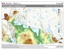
Precipitation across the Prairies was surprisingly similar, with nearly all locations seeing between 10 and 20 millimetres of water-equivalent precipitation, which is near- to slightly above the long-term average for the month. The one outlier was the Brandon region, which reported nearly 32 mm of water-equivalent precipitation in December, well above average for this location.
Who called it?
Overall, December across the Prairies was colder than average with near-average precipitation. Looking back at different forecasts for the month, the winning forecast goes to the CanSIPS or Canadian weather model, which predicted eastern regions with near-average temperatures and western regions with below-average temperatures, and near-average precipitation across all regions.
Now to the latest long-range forecasts, starting with the two almanacs. These forecasts do not change from month to month, but here is a quick summary. The Old Farmer’s Almanac calls for January and February to be colder and snowier than average. The Canadian Farmers’ Almanac calls for below-average temperatures in January and near-average temperatures in February, with above-average precipitation in both months as it mentions stormy weather a couple of times each month.
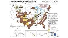
The computer models change every few days in some cases. NOAA calls for colder- than-average temperatures in January and February along with near- to above-average snowfall. The coldest weather compared to average is centred over Alberta, and Manitoba has the best chance of seeing average temperatures.
The CFS model calls for a warmer- and drier-than-average January, followed by below-average temperatures in February. Just like NOAA, the CFS model predicts the coldest weather, compared to average, will be over northern and central Alberta.
Last month’s winning forecast, the CanSIPS model, also calls for a warmer-than- average January followed by a cold February, with the coldest readings once again predicted over Alberta. Precipitation is forecasted to be near average in both months.
As for my best guess. I agree with CanSIPS because all indications are that January will continue to be mild. I think we will see below-average temperatures in February, but only slightly below average. Precipitation forecasts are the toughest, but I lean toward below-average snowfall here in January, followed by near-average snowfall in February.
Now, you know what to do: take a seat and watch what Mother Nature decides to serve.
In the next article we will continue our look at the top weather stories around Canada in 2022, including a record-sized hailstone that fell in Alberta last summer. Until then, enjoy the nice mid-winter weather and remember, the amount of daylight is increasing every day.


