We began our look at the top 2022 weather stories from across Canada a few weeks ago, with particular emphasis on the Prairies.
I covered the top two stories: the series of Colorado lows that pummeled much of Manitoba and parts of Saskatchewan in April and May; and post-tropical storm Fiona that devastated parts of Atlantic Canada.
I read a follow-up article about Fiona in which researchers, using drones, surveyed coastal erosion in Prince Edward Island and found the damage was much worse than initially thought. In fact, damage over large areas exceeded that from any previous hurricane in the region.
Read Also

The lowdown on winter storms on the Prairies
It takes more than just a trough of low pressure to develop an Alberta Clipper or Colorado Low, which are the biggest winter storms in Manitoba. It also takes humidity, temperature changes and a host of other variables coming into play.
This week we will continue our look at the top weather stories from 2022. No. 3 on my list is the strong thunderstorms that caused more than a quarter of a billion dollars’ worth of damage across the Prairies in July.
Fueled by a persistent ridge of high pressure over the central U.S., which pumped warm and relatively moist air northward, a series of at least four severe thunderstorm complexes affected regions of Alberta, Saskatchewan and Manitoba.
The first of these storms hit Alberta on July 7, with an EF-2 tornado and wind speeds between 180 and 190 km/h touching down at Bergen before pounding parts of Calgary with heavy rain, marble-sized hail and heavy wind gusts.
The same disturbance produced more storms the next day in Saskatchewan. Golf ball-sized hail and four tornadoes were reported in parts of Saskatchewan near Paynton and Blaine Lake. This system continued to move east, spawning a small tornado near Argyle, Man., on July 9.
The second storm system developed in Alberta on July 15. These storms dropped large hailstones between Calgary and Edmonton and along the Queen Elizabeth II highway, causing significant property and crop damage.
As the complex moved eastward into Saskatchewan, the severe hail transitioned into strong winds with gusts over 90 km/h. These winds damaged a large part of Grenfell, Sask., ripping the roof off the local hockey rink and toppling grain bins.
The third storm complex started in, you guessed it, Alberta, on July 18. Medicine Hat reported an EF-2 tornado with maximum wind speeds of 190 km/h. Plow winds peaked between 100 and 115 km/h, leaving thousands of residents without power for several days.
Rainfall totals ranged from 60 to 90 millimetres and caused localized flooding over many areas across Alberta and Saskatchewan before moving into Manitoba. There, these storms dropped large quantities of rain, with Teulon and Libau receiving in excess of 140 mm.
The fourth main storm complex began on the last day of July after a period of very warm weather that saw more than 25 temperature records broken in Alberta. This series of thunderstorms was noted for the size of hail that pounded parts of Alberta and Saskatchewan.
When you hear of golf ball- to hen egg-sized hail, you are usually impressed, but the storm system near Markerville, Alta., southwest of Red Deer, had a record-breaking hailstone. Researchers with the Northern Hailstone Project happened to have a team in the area that collected samples of these hailstones. One of them weighed 292 grams and was more than 12 centimetres across. It broke the previous Canadian record of 290 g, set in 1973, for the heaviest hailstone.
Record heat
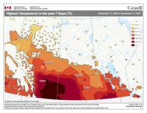
The next 2022 weather event, No. 4 on my list, was the incredible warm weather that brought record-breaking heat in the late summer and early fall. It continued into October, making fall, for some regions, feel like summer never really ended. While all three Prairie provinces experienced this weather, Alberta was the centre of the warmth.
August was one of the hottest months on record for Alberta, with mean daily temperatures running 4 to 6 C warmer than average. In Saskatchewan and Manitoba, it was warm, but not to the same extent, with mean daily temperatures about 2 C warmer than average.
The warm weather continued into September, where once again, Alberta saw mean daily temperatures that were as much as 7 C above average. Medicine Hat recorded a high of 38.3 C on Sept. 3, and Swift Current saw the temperature soar to 36.4 C, breaking the monthly record for both locations.
The well-above-average temperatures continued in October across Alberta, with mean daily temperatures once again averaging between 5 and 7 C above average and Saskatchewan and Manitoba seeing temperatures 2 to 4 C above average. Overall, it was one heck of a fall, especially if you live in Alberta.
We are closing in on the end of January, which means it is almost time for a monthly weather review. Until then, here’s a positive weather thought: the average daily temperature range has now hit its coldest point and is starting to warm up. Why this happens about one month after the shortest day of the year will be the topic for an upcoming article.


