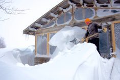
Well, it looks like the models were a little off with the storm system that affected southern Manitoba during the start of this week. While initially the models had this low staying weak and tracking through southern regions, the low was able to tap into some deep moisture from the south which allowed it to strengthen. High pressure building in from the north helped to add some energy to the system, but also pushed it farther south, bringing the heaviest snow to North Dakota and southwestern Manitoba.
Behind this system the weather looks to be fairly quiet. High pressure will be in control of our weather for the most part. Wednesday should start off sunny before a weak front pushes through Thursday that will likely bring some clouds and maybe a flurry. Sunny skies should return by Friday. Temperatures will be in the -5 C range on Wednesday and Thursday, cooling to around -8 to -10 C on Friday and Saturday.
Read Also

June brings drought relief to western Prairies
Farmers on the Canadian Prairies saw more rain in June than they did earlier in the 2025 growing season
We should see temperatures warm up a bit over the weekend as a weak low pressure begins to dominate the region. Clouds will also be on the increase, and we could see some light snow towards the end of the weekend and into the early part of next week as arctic high pressure begins to build southward.
Toward the middle of next week it looks as though temperatures will really cool off. A large area of low pressure is forecast to form over Canada’s East Coast. This will help to pull down a large area of arctic high pressure into our region by Wednesday or Thursday. Under this high we’ll see plenty of sunshine, but temperatures will be on the cold side. High temperatures during the second half of next week are predicted to be around -16 C, with overnight lows around -26 C. Let’s hope the weather models are wrong!
Usual temperature range for this period: Highs, -11 to 2 C; lows, -24 to -7 C.