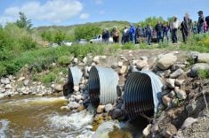
If you read my last weather article, I gave May’s weather statistics a couple of days early hoping that the potential Colorado low was going to either miss us or only bring a little bit of rain. Well, was I wrong! Again. That low brought upward of 80 mm of rain to some areas of southern and central Manitoba and pushed rainfall totals to some extreme levels, not just for May, but for the entire spring.
I knew a few days before this last Colorado low hit that things were not going to be nice weather-wise. Awhile back, the last time we had wet, cool summer weather, I wrote a series of articles on upper-level lows and retrograde motion. Any time you hear those two weather features mentioned at the same time you know your weather is going to be crappy. This is exactly what at least one of the weather models was predicting to happen with this low. The supporting upper low was forecast to break off from the main flow and drift westward and then southward, which it did, and we all know the rest: cold and windy weather to kick off the month of June.

Back to our spring precipitation. According to Rob Paola, a retired Environment Canada meteorologist, this spring (March to May) was the second wettest on record for Winnipeg. The city recorded about 299 mm of water-equivalent precipitation, which was well above the 235 mm that fell in 1911, the third-=wettest year, but short of the 325 mm that fell in the spring of 1896. I then dug into the spring rainfall totals from the Manitoba Ag network and the table here shows the top 10 wettest locations for this spring.
For comparison, the average amount of precipitation across southern Manitoba for this period is about 110 mm. This means these regions have seen 1.5 to almost two times the average. Another way to look at this is by comparing these values to the yearly average total precipitation, which is around 500 mm. So, the spring of 2022 has seen about half a year’s worth of precipitation.
Read Also
Farmer gift idea: How about a weather station?
The 2025 holiday season is looming, and a home weather station might make a great Christmas gift for farmers
A third way of looking at all of this precipitation is to calculate the volume of water that fell across southern Manitoba during this period. This is a question I put to my Grade 8 students, since we were just finishing up our look at scientific notation. Here is what they came up with: math lesson time.
Using Google Earth, we measured out a rectangle for southern Manitoba that had its top around Dauphin. This calculated out to an area of a little over 100 billion square metres or about 1.0 x 10¹¹ m2. We then averaged out the precipitation across this region to be around 200 mm, or 0.2 metre. Turn that into scientific notation and you get 2.0 x 10⁻¹ m. Now for the math:
Volume = area x height
Volume = (1.0 x 10¹¹ m2) x (2.0 x 10-1 m)
Volume = 2.0 x 10¹⁰ m3
That would be: 20 billion cubic metres of water, or 20 cubic kilometres.
If one m3 = 1,000 litres or 1.0 x 10³ l
Then (2.0 x 10¹⁰ m3) x (1.0 x 103 l/m3) = 2.0 x 10¹³ l
That’s 20 trillion litres of water!
If you want to turn that into the number of Olympic swimming pools, then you need to do a little more math. One Olympic pool has 2.5 million litres, or 2.5 x 10⁶ l per pool.
So: (2.0 x 10¹³ l) / (2.5 x 10⁶ l/pool) = 8.0 x 10⁶ pools — or, simply, eight million Olympic pools; that is just crazy.
Isn’t it fun being back in math class?
One more model
The other topic that we discussed in the last issue was the long-range summer weather outlooks. The CanSIPS, or Canadian weather model, had not been updated at that point, but it is now. According to this weather model, June will continue to be cool/cold and wet. July will see slightly warmer temperatures, but still below average. Precipitation will be near to slightly above average. August looks to be the nicest month, with a forecast of above-average temperatures and below-average precipitation.
In my next article I hope to get back to our look at severe summer weather. Looking at the latest medium-range forecasts, my fingers are crossed that we won’t need to discuss another heavy rainfall event.