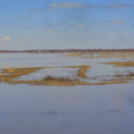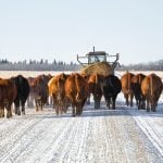
There’s no shortage of concern over spring flooding as the winter winds to an end.

Western Manitoba prepares as province releases its first flood outlook

The Southwest Flood Strategy Committee is among the regional groups preparing 
for possible flood conditions in western Manitoba
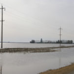
The Southwest Flood Strategy Committee came together for the first time in almost two years Mar. 1, and it’s turning rapt eyes to the spring flood forecast. The group was formed after the 2011 flood — which evacuated 7,100 people from their homes, damaged significant municipal infrastructure and left three million acres of farmland unseeded

Flood risk persists across most of Manitoba

Flood risk persists across most of Manitoba

The Red, Souris, Pembina, Roseau and Lower Assiniboine rivers and Whiteshell Lakes areas 
are all at major risk of flooding, February 27 flood forecast report says

Manitobans have been told to prepare for flooding this spring with the risk of moderate to major flooding persisting in many areas of the province. “At this time, we encourage communities to continue with preparatory measures such as ensuring emergency protocols are in place,” Infrastructure Minister Blaine Pedersen said during the release of the first


Province warns of flood risk

The Manitoba government says high snowfall and wet soils are causing enough concern to warrant an early flood report
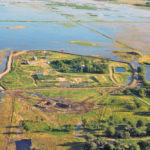
Manitoba could see anything ranging from moderate to severe overland flood risk this spring, according to a provincial “conditions report” issued Jan. 30. Infrastructure Minister Blaine Pedersen said the report, issued earlier than usual and in addition to the expected late-winter forecast, is necessary because a combination of conditions has led to elevated risk. “We

Heavy snowfall and wet fall conditions are causing flood concerns.

Farmers watch nervously as moisture piles up

Government readiness for spring flood questioned as new federal and provincial administrations lack flood-fighting experience

The possible threat of major flooding in Manitoba this spring has Keystone Agricultural Producers worried rookie governments in Winnipeg and Ottawa may not be prepared for it. The combination of fiscal restraint and flood damage could produce a big problem if initial signs of widespread spring flooding turn out to be true, said Dan Mazier,

Multiple flooding events in the Assiniboine River basin the past several years have seen crops losses increase in many jurisdictions.

MCDA updated on progress of Aquanty project

Conservation districts could one day use the program to run water-based scenarios in their jurisdictions

It’s no crystal ball, but when a new computer modelling program now under development is complete, a much clearer picture how various flood and drought scenarios could impact the rural landscape will emerge. Delegates at last month’s Manitoba Conservation District Association annual convention heard more about how a new HydroGeoSphere model under construction will work


ARBI

ARBI drafting long-term work plan for Assiniboine basin

New Framework for Watershed Stewardship will help track progress
The Assiniboine River Basin Initiative (ARBI) has produced a draft plan that lays out what partner organizations hope to achieve for better basin-wide management — and how to go about it. ARBI presented the draft document at its third annual general meeting here last month, asking member organizations for feedback. Called the Framework for Watershed

Co-operation between municipalities can help reduce flooding that otherwise results when water problems are simply passed to the next jurisdiction, the ARBI conference was told.

Flood resilience increasing as jurisdictions co-operate: ARBI

By pulling the pieces of the puzzle together, a better and more co-ordinated approach is possible

Flooding remains a persistent threat, but some farmers and landowners living along the Assiniboine, Souris and Qu’Appelle rivers and their tributaries are now better prepared for the next occurrence. Since 2011 five municipalities along with the City of Brandon, working in Manitoba’s Upper Assiniboine Conservation District, have funded and built several new small dams and

The Assiniboine River Basin encompasses the Qu’Appelle, Souris and Assiniboine sub-basins, across Saskatchewan, Manitoba and North Dakota and is 
162,000 square kilometres in size, which is approximately the same size as the entire state of North Dakota.

Federal investment kick-starts Aquanty project

The Aquanty project is said to be a game changer in how the province will address 
future water management issues within the Assiniboine River Basin

A computer program capable of analyzing the effects of land use and simulating mitigation strategies of an entire river basin seems like a concept stolen from a futuristic movie. However, a $1.1-million investment from the federal government has put the Manitoba Forage and Grassland Association (MFGA) on track for developing just that — a multi-faceted


Once highly productive pastures along the Upper Assiniboine River near the Shellmouth Dam are now saturated with water after years of repeat flooding.

Frustrations rising along the river’s edge

Producers operating in close proximity to the Assiniboine River from the Shellmouth Dam to St. Lazare are struggling to stay afloat

It happens ever year, no matter how wet or dry conditions have been. Water lays in the pastures and fields along the Upper Assiniboine River downstream from the Shellmouth Dam. Cliff Trinder, who runs a cattle operation with 32 miles of river frontage near Russell, describes the situation as “a mess” and says it’s high

Manitoba flood compensation uncertain and slow

Even when compensation is due to landowners from artificial flooding, they say it takes too long and they have to jump through too many hoops to get it. Cliff Trinder says in the past 12 years, he’s had two years he’d consider normal use of the operation’s farmland, but he’s only ever received compensation for