Manitoba Transportation and Infrastructure’s Hydrologic Forecast Centre has issued a flood warning for the Red River Valley. It runs from Emerson to the Red River Floodway inlet just south of the city of Winnipeg.
An overland flood warning continues for southern Manitoba from the Saskatchewan border eastward to Provincial Trunk Highway (PTH) 12 and from the United States border northwards to PTH 1, extending north of PTH 1 between PTH 5 and PTH 16, and north of PTH 1 between Portage la Prairie and Winnipeg. A high water advisory has also been issued for the Whiteshell lakes area, as levels on most lakes continue to rise due to the rain and snow melt.
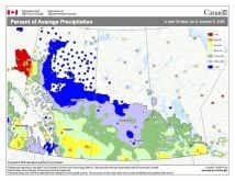
Southern Manitoba basins, including the United States’ portions of the Red, Souris, Pembina and Roseau river basins, have received an average of more than 60 millimetres (mm) of precipitation since April 22.
Read Also
VIDEO: Farmer inflation double that of other Canadians
Darren Bond with Manitoba Agriculture says farm inflation is hitting Manitoba producers as high as 50 per cent over the past five years.
The province is reminding citizens to stay off waterways including creeks, streams, rivers and the floodway. High flows, debris, and cold temperatures present a significant safety risk.
Some ditches and waterways are still ice covered or contain snow-limiting water flows. As high amounts of rainfall occurring in a short period may cause overland flooding, citizens are advised of the potential for the sudden rise of water levels in these areas. Overland flooding occurs when water on the ground surface does not have sufficient time to flow into rivers and streams, potentially causing flooding of low-lying areas, roads and properties.
Water levels on most tributaries in the Red River basin and along the Red River main stem are rising quickly in response to the rainfall and will continue to rise over the coming days. Daily average temperatures are forecast to remain around zero until Tuesday, April 26, which will temporarily slow down the melting of the remaining snow, but are expected to increase to above zero by mid-week.
Flood forecasters will continue to monitor precipitation amounts and assess its impacts on flows and levels. The most recent river forecast information can be found at gov.mb.ca/mit/floodinfo/index.html.
The government is also cautioning drivers to stay off closed roads and not attempt to travel across inundated roads. For current highway conditions and road closures, call 511 or visit manitoba511.ca/en/.
For more information about flooding in Manitoba, visit manitoba.ca/flood.


