
The Climate Atlas of Canada, developed to show how climate change will specifically affect the country’s regions, now has a section aimed specifically at farmers.
This is the free, online resource created by the Prairie Climate Centre in Winnipeg to combine climatology and scientific data to showing the future climate, depending on progress made — or not made — to bring down current GHG emissions.
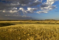
Under worst-case scenarios, for example, Manitoba’s climate could become more like Nebraska and South Dakota by 2050 and northern Kansas and even Texas by 2080, the atlas shows.
Read Also

June brings drought relief to western Prairies
Farmers on the Canadian Prairies saw more rain in June than they did earlier in the 2025 growing season
It also projects very specific climate data for 2,000 towns, cities and regions across Canada so people can see how global climate change will affect them locally.
On April 20 the team of the PCC released a new platform of the atlas that’s directed at the agricultural sector.
This aspect of the atlas was developed with help from Keystone Agricultural Producers to give farmers specific data variables on how climate change will affect where they farm and help inform their farm management decisions, said Ian Mauro, a co-director of the Prairie Climate Centre and principal of the Richardson College for the Environment at University of Winnipeg.
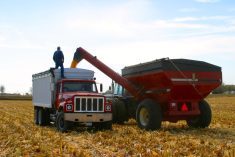
As the climate warms up farmers will be growing different crops and managing landscapes very differently than they do today.
“But you can’t adapt until you know what you’re adapting to,” said Mauro. “And you can’t know that unless you have data about your location.
“The atlas pinpoints very specific information.”
In Manitoba, for example, it depicts an anticipated 33 additional frost-free days in the Brandon area in future, and projects the hottest summer day temperatures in the Dauphin region could reach 38 C or 4° higher than average now.
Agriculture can very likely adapt to climate change but it will take time and good decisions need as much information as possible, Mauro said.
This is about making climate change a “solvable problem,” he said.
“We don’t want these maps to scare people. We want these maps to inspire people to move forward.”
The agriculture section was compiled in consultation with farmers who are already thinking about the impact of climate change and taking action on their farms. It includes short videos featuring farmers who’ve adopted initiatives such as on-farm renewable energy sources or rotational grazing approaches to both benefit soil and sequester carbon.
Danny Blair, University of Winnipeg climatologist and co-director of the PCC said the goal in developing the agricultural section is to give farmers information so they recognize the opportunities and risks ahead of them.
“There are opportunities coming because of some of the changes in the growing conditions,” said Blair.
“It seems inevitable that farmers will migrate to new varieties that require more heat, and we’ll see certain things grow and thrive and hopefully be profitable with new kinds of markets.
“But there are risks that will have to be managed as well. The caveat is precipitation. The story we’re telling is we need to get ready… to take advantage of the opportunities presented by extra heat and a longer growing season, but to adapt towards the likelihood of more frequent conditions of water stress.”
That will require a different way of managing the landscape for what’s expected to be more frequent and extreme wet and dry periods.
“We’re talking about a future climate where the risk to farmers is amplified because we’re talking about multiple disasters in a single farming season,” said Mauro.
“This is what people need to get ready for. We need to get much smarter about water.
“We need to figure out how to retain water when it’s available to us so we have it when it’s not. This is a critical thing in terms of how we manage landscapes in a different kind of way.
“This is a provincial issue and has to do with infrastructure and big policy decisions.”
The Canadian Institute of Planners and the Canadian Association of Landscape Architects describe the atlas as ‘a missing piece’ for planning, Mauro added. Planning infrastructure and the design of communities can’t continue on the basis of what’s “normal” for climate now, and must begin accounting for climate change too, these professionals tell the PCC.
The Climate Atlas of Canada is considered a unique tool worldwide for helping people grasp the impact of climate change at the local level, Mauro noted.
“We’re not aware of any tool in the world that allows you to go in and click into any region of the country to get localized climate data.”
Visit the website for the Climate Atlas of Canada.