Before we peer into this week’s forecast, I need to clarify a few things, after receiving a few emails. First off, the forecast that I create cover the agricultural regions of the prairies. So, in Alberta that would cover southern and central regions, and when I talk about northern regions, I am referring to the Peace River region. In Saskatchewan and Manitoba, it is southern and central regions–a little further north in Saskatchewan than in Manitoba.
Secondly, my forecasts are mostly based off three different weather models. I watch the GFS (Global Forecast System) which is out of the United States; the CMC (Canadian Meteorological Center) which is Canadian of course; and the ECMWF, which is a product of the European Center for Medium-range Weather Forecasts. I watch them several times a day to see how they’ve been handling the forecasts and then make decisions on which models or combinations of models I trust when putting together a forecast. I will do a write up about this soon for those that are interested in creating their own forecasts.
Read Also
Prairie forecast: Extended cold snap as Arctic high pressure moves in
Artic high pressure will dominate Prairie weather between January 21 and 28, which means a low chance of storms or significant precipitation.
Now, on the forecast.
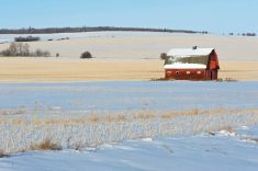
For this forecast period, it looks like the well above average temperatures that flooded across the prairies over the last week or so will be coming to an end, at least eventually. The good news is that it doesn’t look like it will be an abrupt end with well below average temperatures moving in. Instead, it looks like temperatures will slowly cool towards more average temperatures for this time of the year. For those of you looking for snow, it does not look the prairies will see much of the white stuff.
This forecast period starts off with an area of low pressure exiting the northern prairies and a building area of high pressure over B.C. The flow around these two features will span most of the prairies in a northwesterly flow. This will push temperatures down a little bit from the very warm highs seen earlier in the week. The models are showing an area of low pressure forming along the Canada-US boarder late Wednesday and then racing eastwards on Thursday. This low will bring a quick shot of snow, rain, or a bit of both to southern Saskatchewan and Manitoba on Thursday and Thursday night.
The building high over Alberta will allow temperatures to rebound back into above average values over the weekend as an area of low pressures forms over northern Alberta. As this low moves eastwards, this pocket of warm air will quickly shift into Saskatchewan by Sunday and into Manitoba on Monday before collapsing southwards. Behind this low, colder air will begin to invade southwards across the prairies as a large trough of low pressure develops over Hudson Bay. This will bring much more seasonable temperatures across all regions by Tuesday or Wednesday.
Alberta
This region will see a coolish start to this forecast period as colder air tries to build southwards ahead of a building area of high pressure over B.C. That said, daytime highs still look to be in the 2 to 4 C range with overnight lows falling to around -5 C. Southern regions could see some showers or flurries as an area of low pressure develops along the boarder on Wednesday. This low will quickly move off to the east and as the B.C. high slides to the southeast. This will then allow for a mild Pacific flow to develop across the province pushing high temperatures back towards the 10 C mark by Friday or Saturday. These warm temperatures will last until Sunday or Monday before more seasonable air pushes in from the north early next week. As the colder air pushes southwards there may be a few flurries especially over more northern and western regions.
Saskatchewan
This region will see a mix of sun and clouds to start off this forecast period. Temperatures will be on the mild side with daytime highs mostly in the 0 to 2 C range. Extreme southern regions could see a quick shot of snow on Thursday as an area of low-pressure zip along the border. Cool conditions will persist into Friday and possibly Saturday before mild air moves in thanks a southerly flow developing ahead of an area of low pressure crossing across the far northern parts of the province. Expect daytime high to warm back into the 6 to 10 C range over the weekend with overnight lows only dropping into the low single digits. Colder air will begin to work its way south sometime on Monday with daytime highs dropping back below freezing by Tuesday.
Manitoba
Manitoba will see one last day of nice warm temperatures before seeing a bit of a cool down. An area of low pressure is forecasted to track across the southern half of the province on Thursday bringing a fairly narrow band of snow. Considering the speed of this system, only a few centimeters of snow are expected. With temperatures near the freezing point, not much of what does fall should accumulate. Over the weekend, temperatures will moderate once again thank to the southerly flow ahead of an area of low pressure cross northern Manitoba. Expect daytime highs to push into the 5 to 8 C range by Sunday or Monday. These warm temperatures do not look to stick around long as colder air moves in on Tuesday dropping daytime highs back into the -2 to -4 C range to end this forecast period.
—Daniel Bezte is a teacher by profession with a B.A. (Hon.) in geography, specializing in climatology from the University of Winnipeg. He operates a computerized weather station near Birds Hill Park, Man. Contact him via email with your questions and comments.