The beginning of the new year is always a busy time when writing about the weather. In the last issue I started writing about the top worldwide weather stories for each month in 2012 and it will take another issue or two to finish that up. Environment Canada has also come out with its top weather stories for Canada during 2012 and I need to take a look at these sometime during the next month as well. I also mentioned back in early December that I felt we’ve been seeing more melting occurring during the winters over the last five to 10 years, and that I will look into this in more detail sometime soon. So, all in all, I have a lot of work ahead of me!
Read Also
Forecasting spring 2026 weather on the Prairies
What weather can farmers expect across Manitoba, Alberta and Saskatchewan as they head into seeding? Plus: a lesson on what makes the seasons turn
As usual, to start off every month I like to take a bit of time to look back at the previous month’s weather, check to see whose forecast was most accurate, and then look ahead to see just what type of weather we might expect over the rest of this month. Trying to figure out the previous month’s weather is getting tougher and tougher all the time. I usually rely on Environment Canada’s weather data for the three main areas of agricultural Manitoba (Winnipeg, Brandon and Dauphin). Those of you who regularly read this article are already aware that Dauphin’s data has gone missing from that website — and now Brandon’s data is also no longer available. This means the only station left is Winnipeg and, if I go farther north, The Pas has data available.
To try and resolve this problem I then went to check out Manitoba’s weather website; they haven’t updated their data since Nov. 4, so no help there. My last resort was to go to my favourite weather website, wunderground.com, and while it had the data for Brandon, I am more than a little bit suspicious about the data. During the period of Dec. 24-27, Brandon was reported to have had overnight lows in the -37 to -42 C range. While it was cold around Christmastime I don’t remember any mention of temperatures this cold. I looked around at some of the nearby personal weather stations (thanks, Lisa’s Back 40) and none of them reported temperatures any colder than -30 C during that period.
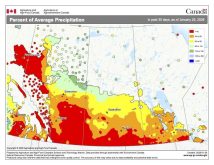
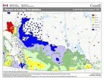
So, to sum it all up it looks like I will have to rely mostly on Winnipeg’s data, with a little help from The Pas, to try to determine the overall weather conditions for the month of December — not an ideal situation, to say the least. If we use these two sources it appears December, 2012 came in just a little bit colder than average, with these two stations coming in less than 1° colder than average. It also appears southern regions were drier than average, with near to slightly above-average amounts farther north.
December started off warm, with high temperatures in some areas making it above 0 C. Temperatures then cooled down during the second week of the month before warming back up again around the middle of the month. Temperatures then began to cool down once again as Christmas approached, with the coldest temperatures of the year moving in over the holidays and several locations reporting their first -30 C or colder night since last January. Precipitation was light for the most part, especially the farther south you went. Over northern regions, a storm system early in the month brought most of the snow, with upward of 20 to 30 cm reported.
Who called it?
Looking back at the forecast for December, it appears no one was on the mark this time. The Canadian Farmers’ Almanac was the only one predicting near- to slightly below-average temperatures, but it, along with everyone else, also called for above-average amounts of snow.
Let’s look ahead to see what the rest of January might have in store for us. According to Environment Canada, January is going to have above average temperatures over southeastern regions, with near-average temperatures elsewhere. Precipitation amounts are also supposed to be near average for the month.
The folks over at the Old Farmer’s Almanac call for near- to slightly above-average temperatures for the month and near-average amounts of precipitation. The Canadian Farmers’ Almanac goes in the opposite direction, calling for colder-than-average conditions with above-average amounts of snow.
Finally, here at the Co-operator, I am calling for near-average temperatures. It looks as though the first two weeks of January will be fairly mild, but that mild weather looks like it will be replaced by cooler temperatures to start the second half of the month. Precipitation is always the tough one to figure out, but it looks as though we’ll probably see near- to slightly below-average amounts, as there will be several chances for snow during the first couple of weeks, before what appears to be a drier pattern moves in.


