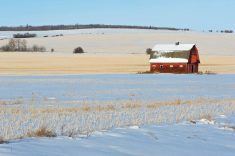
Once again, the forecast models did a fairly good job. The prairies did see the arrival of more typical winter temperatures and, as the cold air moved southwards, two areas of low pressure did spin up and cross the prairies bringing light snow. There were two areas where the models were a little off. First, the cold air took a little longer to drop southwards, and when it did it invaded all three prairie provinces at about the same pace. Second, the last area of low pressure turned out to be a little stronger than expected and brought a swath of 5 to 10 cm of snow through south-central Saskatchewan and parts of southern Manitoba.
Read Also
Prairie forecast: Extended cold snap as Arctic high pressure moves in
Artic high pressure will dominate Prairie weather between January 21 and 28, which means a low chance of storms or significant precipitation.
For this forecast period, it looks like the prairies will be locked into a cold arctic flow, which brings the first long-lasting cold snap of the winter. The weather models are showing a strong area of low pressure moving into southern Ontario this weekend. This low is then forecasted to move north into Quebec before retrograding back to the west over Hudson Bay. It then drops southwards into northwestern Ontario. This feature will create a large deep upper trough of low pressure over much of North America and the counterclockwise rotation around the low will help to draw cold arctic air southwards.
Coldest temperatures look to be over the western prairies but there looks to be some relief from the really cold temperatures early next week. With cold arctic high pressure dominating, little in the way of snow is expected during this forecast period.
Alberta
It looks like Alberta will feel the brunt of this outbreak of cold air. The weather models are showing frigid temperatures moving in on Thursday with the heart of the cold air covering pretty much the whole province by Friday or Saturday. Expect daytime highs to only be in the mid -20’s with overnight lows falling well into the -30’s C. There are even some hints that a few naturally cold locations could see -40 C.
The core of the arctic air will begin moving out by Monday with daytime highs rebounding into the -10 C range. Temperatures should be similar or possibly a little warmer on Tuesday and Wednesday before colder air begins to drop southwards later in the week. As the milder air pushes in from the southwest and rides up over the colder air, there may be some scattered snow showers but coverage and amounts look to be light at this point.
Saskatchewan
For Saskatchewan, this forecast period starts off with a departing area of low pressure that brought measurable snowfall to south-central regions overnight and into this morning. Behind this low, arctic air will begin to pour southwards and will drop daytime highs into the mid -20’s C by Friday. Overnight lows will drop into the low to mid -30’s. The coldest air looks to be over western regions. Some of the weather models show overnight lows on Saturday morning dropping to -40 C.
These cold temperatures look like they’ll stick around until at least Monday before milder air begins flooding in from the west. Look for temperatures to moderate on Tuesday and Wednesday, but don’t expect a return to above freezing values. Daytime highs are forecasted to be in the -10 to -15 C range with overnight lows falling into the -20 to -24 C range. With cold arctic air dominating, little in the way of snow is expected. Best chances for any snowfall would be next Tuesday or Wednesday over western regions as the mild air tries to push in from Alberta.
Manitoba
Manitoba has the most interesting forecast for this period. It starts off with the Alberta Clipper system moving into the province. As the system moves in, it’s expected to weaken and drop off to the south leaving a trailing inverted trough of low pressure to linger over the region on Thursday.
The weather models are not in full agreement on how to handle this system. The GFS model only shows 2 to 4 cm of snow over eastern region with up to 10 cm of snow over western areas. The ECMWF model is a little heavier with the snow–forecasting western regions to see 15 cm, central regions 10 cm and eastern region about 5 cm. We will have to watch the inverted trough on Thursday, but indications right now are that only an additions 2 to 4 cm of snow are expected from this feature.
Once the trough moves off on Friday, the forecast really gets interesting. Cold air will begin to push in from the northwest dropping daytime highs into the -20 C range. Overnight lows will fall to around -30 C, with far western regions possibly seeing lows dropping to around -35 C.
Late in the weekend, and into the early part of next week, an area of low pressure is forecasted to retrograde into northwestern Ontario pushing in slightly milder air from the northeast. Expect daytime highs to warm back towards the -15 C range with overnight lows falling to around -20 C.
The low is also expected to push some moisture into the region and bring scattered periods of light snow to eastern regions on Monday and Tuesday before it breaks down on Wednesday.