As I write this it is not quite the end of April, and with the third Colorado low in three weeks expected to hit a large part of southern Manitoba over the final day of the month, I had to hem and haw as to whether I should try and write up a month-end review. Looking back, though, one more major rain event will not change the fact that overall, April was one very wet month.
Read Also
Why is the sky blue?
The colour of the skies, on the Prairies and elsewhere, tells the story of the paths sunlight takes as it enters Earth’s atmosphere, Daniel Bezte writes.
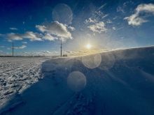
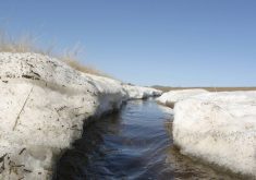
The next issue I had to wrestle with was whether we should even take a look back at this past April. After all, even without doing a deep dive into all the weather statistics, it was probably the worst April weather on record. In a previous column, we talked about how this year would likely be the latest start to spring on record — and looking at the official data from Winnipeg it is either going to be tied or will beat the record by a day. Trouble with the official data is, it often does not properly represent what is happening on people’s property. While the official weather station might say there is no snow on the ground, the snow trapped by bushes and trees on properties means zero snow cover for a number of yards won’t happen until early May. I know at my place, I still have two-foot drifts covering larger portions of my yard. April 28 was the first day that I actually saw some of the soil exposed in my gardens.
Well, I guess we should look back. Unless you were away or lived in your basement the whole month, it was definitely colder than average, and for most places much wetter than average. The Winnipeg region was the unexpected warm spot, with a mean monthly temperature of around 0.5 C, which came in right around 4 C below average. That, by the way, is way, way, way below average. In fact, the warmest temperature so far this year in Winnipeg occurred in March, not April. The Brandon and Dauphin regions were even colder compared to average, despite the fact that western regions are often warmer than Winnipeg in the spring. Both regions saw mean monthly temperatures in April that were about 4.5 C below average, with readings of -0.5 C in Brandon and -1 C in Dauphin. I did not keep count, but there were a fair number of cold records broken in April, and while it was cold, 1996 was still the coldest April on record, with a mean monthly temperature of -1.6 C in the Winnipeg region.
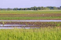
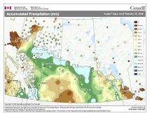
Precipitation was far above average in April. With the pattern switch from the northwesterly flow of Alberta clippers in winter to the moist southwesterly flow of the Colorado lows in April, it is not surprising more southern and eastern regions ended up seeing the largest amounts of precipitation — not counting the orographically enhanced precipitation regions (you know who you are). Not including any rainfall that falls on April 29 and 30, which could be significant, the wet spot for April was the Winnipeg region, with around 74 mm of precipitation. The Brandon region came in second with around 55 mm. Both of these values are well above the typical April average of between 25 and 30 mm. Dauphin saw about 30 mm of precipitation in April and, being farther to the northwest and off the Colorado low track, this was near average.
Who called it?
Overall, I think it is safe to say that it was a cold and wet April, the kind of April you would rather just forget about. For the first time in memory there were three different forecasts that called it correctly. First was the Canadian Farmers’ Almanac, then the Canadian CanSIPS weather model and finally my own forecast which sided with the CanSIPS model. With all this accuracy and consensus, let us see what the latest May and June forecasts call for.
As usual, starting off with the almanacs: the Old Farmer’s Almanac calls for well-above-average temperatures and precipitation in May, followed by near-average temperatures in June along with below-average rainfall — an interesting two-month forecast. The Canadian Farmers’ Almanac appears to call for average- to below-average temperatures in May along with above-average precipitation. I do not have a June forecast as its website is glitching again and not allowing me to see beyond two months, even though I have a paid subscription. This has happened several times over the past few years.
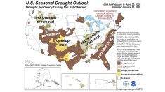
Next up, the weather models: extrapolating NOAA’s forecast past the border (I still do not know why they need to delete their data for Canada as their model is calculating it), it looks like May and June will see both near-average temperatures and precipitation. The CFS model, which has not been doing that well lately, is calling for near- to maybe slightly below-average temperatures in May with the best bet of below-average temperatures over far-western regions. Temperatures look to warm to above-average values in June. The CFS precipitation forecast calls for near- to slightly above-average values in May with near-average amounts in June.
Moving on to the CanSIPS model, it calls for near-average temperatures in May followed by above-average temperatures in June. It calls for a return of dry weather with below-average amounts of precipitation in both months.
Finally, in my forecast I am calling for a switch to above-average temperatures in both May and June, along with near-average precipitation. I do think we will see a more active thunderstorm season this year, which could lead to higher-than-expected rainfall, but for now I will stick with a call for near-average rainfall.


