The weather page is prepared by Daniel Bezte. Dan has a BA Honours degree in geography, specializing in climatology, from the U of W. He has taught climate and weather classes at the U of W, and is a guest climate expert on CJOB’s morning show with Larry Updike. Daniel runs a computerized weather station on his 10 acres near Birds Hill Park, which he plans to develop into a small vegetable and fruit hobby farm.
Daniel welcomes questions and comments at [email protected]
Read Also

June brings drought relief to western Prairies
Farmers on the Canadian Prairies saw more rain in June than they did earlier in the 2025 growing season
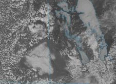
Finally it seems like we’re seeing more than just a couple of days of sunshine across pretty much all of agricultural Manitoba, so instead of continuing our talk about clouds, it’s time for our monthly review of the weather and then a look ahead to see what September might have in store for us.
Well, I guess the weather story for August was cooler-than-average temperatures for the ninth month in a row! It wasn’t record-breaking cold in August; in fact, most places only averaged about 1C below their long-term average for the month. Still, it was below average and I think pretty much everybody is getting just a little bit tired of month after month of belowaverage temperatures.
Looking at precipitation for the month, most places were, once again, above the long-term average. There were a few locations, such as Winnipeg, which actually came in a little below average, but with the cool and cloudy conditions it still seemed like the precipitation was above average due to the low amount of evaporation taking place.
As I pointed out a couple of articles ago, while it has been cool for a long time now, we really haven’t broken any extreme temperature records. With this being the ninth month in a row with belowaverage temperatures, we have now broken the record for longest cold snap (for lack of a better term). According to Environment Canada, the last time we saw eight months in a row with below-average temperatures was back in 1995-96 and in 1978-79. Interestingly, both of these cold snaps occurred mostly during the winter and spring and did not go into the summer – just our luck!
WHO CALLED IT?
Was anyone able to predict the cool and wet August? Looking back, it seems that the Canadian Farmers’ Almanac would be the winner, with its apparent call of below-average temperatures and aboveaverage rainfall. It seems like the wishful thinking of both Environment Canada and us here at the Co-operator were not enough to turn the weather tide.
Now, what will September’s weather be like this year? It looks like there are two different camps between our four different forecasters. In our first camp, both of the almanacs call for a 10th month in a row of belowaverage temperatures and both appear to call for near-average amounts of precipitation. The Canadian Farmers’ Almanac seems to be calling for plenty of light showers over the month of September, while the Old Farmer’s Almanac predicts below-average amounts of precipitation over eastern areas and above-average over western regions, so I cut it down the middle and went with near-average amounts.
Our second camp is made up of Environment Canada and me. EC’s longer-range models seem to be pointing toward warmer-than-average temperatures during September for nearly all of Canada. This forecast by Environment Canada is produced by combining the results of 40 different weather models, but what these models look at and how they all work is beyond me. While I am agreeing with EC’s call for above-average temperatures in September, my reasons are a little more straightforward. First of all, the odds of seeing a 10th month in a row of below-average temperatures must be getting pretty darn high – but I’ve been saying that for several months now, so why would September be any different?
Well, secondly, we have been seeing an El Nińo event building over the Pacific for the last several months, and while this weather event does not seem to have much impact on our weather during the summer, it does seem to have a stronger impact as we move into winter. More often than not, during an El Nińo winter, our region of the world will see above-average temperatures. So I figure in September we just might start to see the beginning of a warm El Nińo fall and winter.
As for precipi tat ion, Environment Canada is calling for near-to slightly aboveaverage amounts, while here at the Co-operator, I am calling for near-average amounts. I think we have all paid the price of a cold spring and summer and I think it is time we get what is owed to us, a nice warm fall and winter!