If you like your summers hot and dry with plenty of sunshine, then July in southern Manitoba was exactly the place to be. After a questionable start to summer back in June, a number of people were worried it was going to be a “here you go again” summer, with lots of rain and cool temperatures.
The heat actually turned on right at the end of June. Up to the last two days the temperatures in June where nothing to write home about. There were a few nice days here and there, but no really hot weather. Then, on the 29th, temperatures began to climb, and by the 30th most places saw temperatures in the low to mid-30s for highs – and these warm temperatures, for the most part, have continued ever since.
Read Also

Thunderstorms and straight-line winds
Straight-line winds in thunderstorms can cause as much damage as a tornado and are next on our weather school list exploring how and why severe summer weather forms.
So July was warm, but just how warm? Every station I checked had a mean monthly temperature that was greater than its long-term average. The warmest region seemed to be the central parts of agricultural Manitoba, while the western regions were the coolest. The Winnipeg region recorded a mean monthly temperature of about 21 C, which is nearly 2 above its long-term average. Farther west, Brandon recorded a mean monthly temperature of 20 C, about 1 above average. The Dauphin region also came in about 1 above average, with a mean monthly temperature of 19 C.
The main weather story for the month was probably the heat wave that began July 14 and lasted in some areas for the next eight days. This heat wave brought some of the warmest temperatures our region has seen over the past 10 years, with several locations breaking or tying their record highs. The heat peaked July 19, when the mercury soared to over 36 C at several locations in south-central Manitoba. With the heat came humidity, and while no humidex records were broken that I know of, it made the already hot weather feel even hotter.
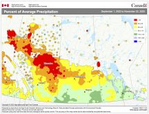
Normally when we see a lot of summer heat and high humidity levels, this usually leads to a lot of thunderstorms and heavy rains, but this didn’t materialize this July. We did get thunderstorms during the month, but they were generally hit and miss, with only a few areas seeing any real heavy rainfall. Overall, the month of July was pretty dry across our region, with all three of our main centres recording below-average amounts of precipitation. While this dry weather was good news for the waterlogged regions, eastern regions saw the beginnings of drought conditions develop during the month.
The Winnipeg region saw only around 10 millimetres of rain during July. Combine that with all the sunny, hot weather and that spells dry with a capital “D.” Farther west in Brandon, thunderstorms brought more rain, with that region seeing around 60 mm of rain, about 15 mm below average. Up in the Dauphin area they reported about 50 mm of rain, or about 25 mm below average.
WHO CALLED IT?
I think it’s safe to say July 2011 was warm and dry. Now the question is, who was able to predict this weather? Looking back it appears theOld Farmer’s Almanac,along with us here at theCo-operator,did the best job. Both of us called for above-average temperatures and I even called for some really hot weather during the second half of the month. TheAlmanac called for below-average amounts of precipitation while I called for a bit of a mixed bag, with some areas seeing below average and a few areas seeing above average.
Now, on to August’s outlook: will the warm start to the month continue on through the month or will we see a switch in the pattern? According to Environment Canada, August is going to be warm, with all areas seeing above-average temperatures. It also predicts wet weather moving in, with southern regions having a good chance at seeing above-average amounts of rain. Over at theOld Farmer’s Almanacthey call for near-average temperatures and precipitation. The Canadian Farmers’ Almanac appears to call for above-average temperatures with below-average rainfall, as it mentions hot and pleasant weather with only the odd period with thunderstorms.
Finally, here at theCo-operator, I think we’ll see a continuation of the above-average temperatures during August. There is a chance we might see a switch to a cooler weather pattern during the second half of the month, but confidence in this is pretty low right now. As for rainfall, I feel the current dry weather will continue and we’ll see below-average amounts of rain. However, if we do see the switch to cooler weather during the second half of the month, then most areas will probably come in with near-average amounts of precipitation.


