This time last week I was saying that we’d either have dodged a big snowstorm or we’d be digging out from one. As it turned out, it was a little bit of both. Western regions pretty much missed out on the storm as it tracked southwestward through Alberta and southern Saskatchewan. The storm then curved back to the northeast and brought some significant snowfall to southeastern areas. What we didn’t miss out on was the cold arctic high pressure that moved in behind the storm system — and just our luck, the arctic air ended up being colder than expected!
Read Also

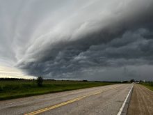
Thunderstorms and straight-line winds
Straight-line winds in thunderstorms can cause as much damage as a tornado and are next on our weather school list exploring how and why severe summer weather forms.
For this forecast period it looks like the cold weather will continue. With arctic high pressure dominating the region we’ll be seeing plenty of sunshine and cold temperatures with little in the way of any snow, at least for the first half of this forecast period. The first area of arctic high pressure will move across the region during the first half of this week. This will be followed by another arctic high on the weekend. We might see slightly warmer temperatures on Friday, along with the odd flurry as energy from a storm system off of the West Coast tries to push eastward ahead of the arctic high.
This second region of high pressure looks as if it will take a more easterly track. Should this happen, it will keep the coldest air to our east, over Ontario. This will also allow energy and moisture from the Pacific to move into our region, bringing a chance for some snow late on Sunday and into Monday. The weather models then show another area of low pressure from the Pacific sliding through our region around the middle of next week, bringing with it another chance for some light snow. This will be followed once again by more arctic air. The good news is that the long-range models are starting to hint at mild air moving in just in time for Christmas.
Usual temperature range for this period: Highs, -18 to -2 C; lows, -28 to -11 C.