The Red River is Manitoba’s biggest flood risk this spring, at least so far.
The province’s flood outlook, released March 22, flagged the Red River as the only major risk area, with “low to moderate risk of flooding in most Manitoba basins.”
The main stem of the Red River between the international border at Emerson and the Winnipeg floodway will likely by affected by the melt of above normal snowpack in the U.S., Manitoba Transportation and Infrastructure’s Hydrologic Forecast Centre said.
Read Also

From farm gate to Grade 4: CALM celebrates 15 years in Manitoba classrooms
Canadian Agriculture Literacy Month marks its 15th year with 159 volunteers visiting 436 Manitoba classrooms to connect students with agriculture.
The centre is not expecting water levels to outmatch current flood protections. Levels are expected to remain within dike capacities and “below community or individual flood protection levels” in all locations where those measures have been installed.
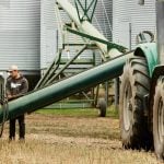
The Red River Floodway is expected to open this spring in response to rising waters.
Ice breaking work is also complete on the Red River and Icelandic River in a bid to avoid ice jams. Ice dam risk on the Assiniboine River was deemed too low for icebreaking work, although the province has said it expects to open the Portage Diversion to help limit ice jamming east of Portage la Prairie and to control water levels downstream.
Risk along the Assiniboine River and Fisher and Icelandic rivers in the Interlake sits at low to moderate. Other areas in southern Manitoba, including the Souris, Roseau, Rat and Pembina rivers, are all at low risk of spilling their banks.
Most other basins, such as the Saskatchewan River, Whiteshell region and northern Manitoba, share the low risk.
Dauphin Lake and Lake St. Martin are the unfortunate exceptions to an otherwise mild flood forecast for Manitoba lakes. Levels on Lake Winnipeg and Lake Manitoba are both expected to stay inside normal ranges for spring, as are water levels on most of the province’s water bodies.
The flood forecast has been helped by Manitoba’s less than saturated soils. Soil moisture was largely normal to below normal at freeze up in 2022, the report notes, thanks to dry conditions in fall and late summer.
There were some patchy exceptions in the Interlake and central Manitoba, where soils were wet when frost set in.
Around the Red River, including now snow-packed regions in the U.S., soil moisture was low going into winter.
Most central and southern Manitoba river basins have also been less than inundated with snow this winter, although the trend does not hold true for northern Manitoba, which saw normal to above normal precipitation.
The report cautioned that intervening conditions before spring melt will still affect how much of the province goes under water.
Longer-range outlooks forecast normal precipitation through to July, although the centre warned that longer-term forecasts are often unreliable. It’s unlikely, however, that water will start to flow in earnest this month given continued temperatures below freezing.
The centre expects spring runoff to start in early April.
“A late thaw and spring rainstorms could result in a rapid snow melt that increases overland flooding and flows on tributary streams and larger rivers,” the report read.