Want a bird’s-eye view of your crop, find stray steers, or safely monitor a cow calving on pasture?
It’s getting easier and cheaper to do with a wide array of drones on the market, says Rejean Picard, Manitoba Agriculture, Food and Rural Development’s (MAFRD) farm production adviser in Somerset.
Once almost exclusively used by soldiers and spies, drones could be the next new agricultural innovation to “take off” — pun intended.
Read Also
Manitoba sclerotinia picture mixed for 2025
Variations in weather and crop development in this year’s Manitoba canola fields make blanket sclerotinia outlooks hard to pin down
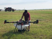
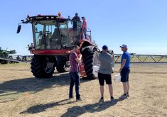
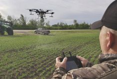
Picard is experimenting this summer with a camera-equipped ’copter drone.
“I think it will become a pretty useful unit,” for both farmers and crop consultants,” he said during an MAFRD webinar June 12. “Because it’s not necessarily a very high cost and it can be used right through the whole season I think it has some really good potential.”
In an interview later Picard said drones won’t eliminate the need for farmers to walk their fields.
“It provides a good first overview that can identify areas that need closer attention,” he said.
Drones start at less than $1,000 and go up to tens of thousands of dollars.
More expensive fixed-wing drones can be programmed to fly over a specific area and have geo-referencing software and can take near-infrared (NIR) images, used to assess vegetative growth. But in many applications drones are cheaper than hiring a manned aircraft or buying satellite images, Picard said. More expensive drones can be used to map fields, assess crop development and compare against maps generated by combine yield monitors.
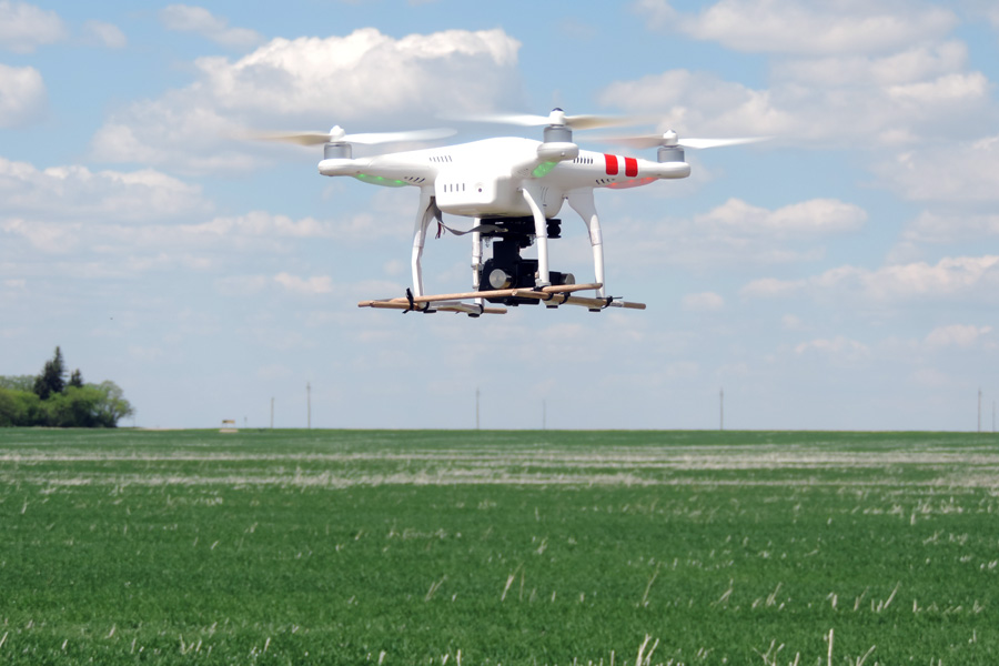
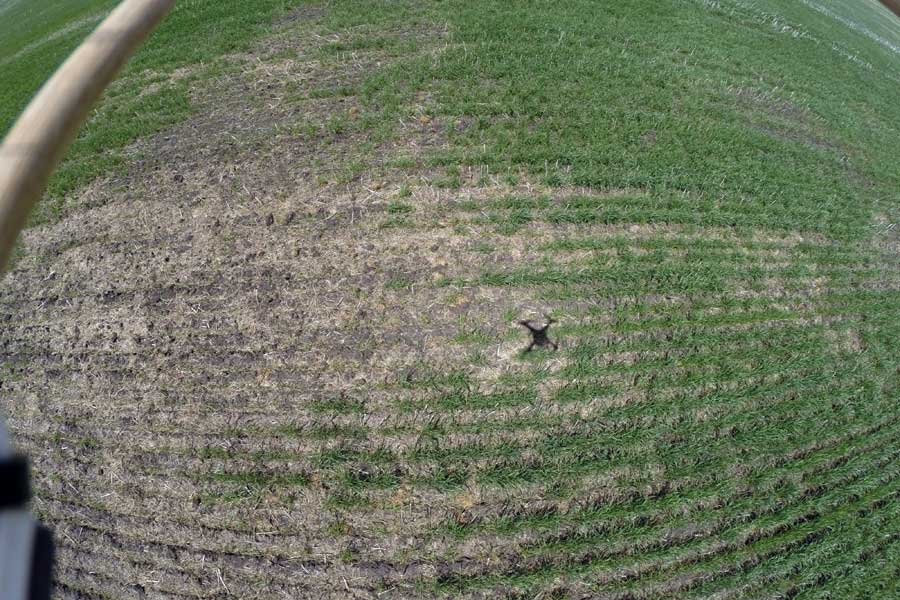
The four-propeller, battery-powered DGI Phantom 2 drone Picard flies costs around $700, but adding a gimbal (a pivoted support that allows the rotation of an object about a single axis) and GroPro still and video camera brought the price to $2,500. It also includes a seven-inch screen that allows the pilot to see live what the camera sees. Picard said that helps because once the drone gets farther away, it’s hard to know if it’s flying towards or away from the pilot.
- More from the Manitoba Co-operator: The drones are coming to a sky near you
Easy to manoeuvre
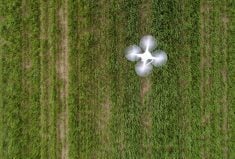
The ’copter drone is relatively easy to manoeuvre and can fly several hundred feet high or inches from the ground. It can also hover — a nice feature when the operator wants to take a close look at a part of the field.
“It can hover a couple of feet off the ground, take a picture and then you can upload it to your computer,” Picard said. “I think you could even do plant counts if you know the seed row spacing.”
Flying the drone takes practice, he said. Picard has had a couple of rough landings resulting in damaged propellers, but they are relatively inexpensive to replace.
Picard’s ’copter drone has GPS and a compass, which he said helps keep it stable, even under relatively windy conditions.
The 12-megapixel GroPro camera can look forward or straight down. While the wide-angle lens captures a big area, it also distorts the view, making it difficult to piece pictures of a field together to get a composite view.
Crop monitoring and assessment are the obvious uses for drones.
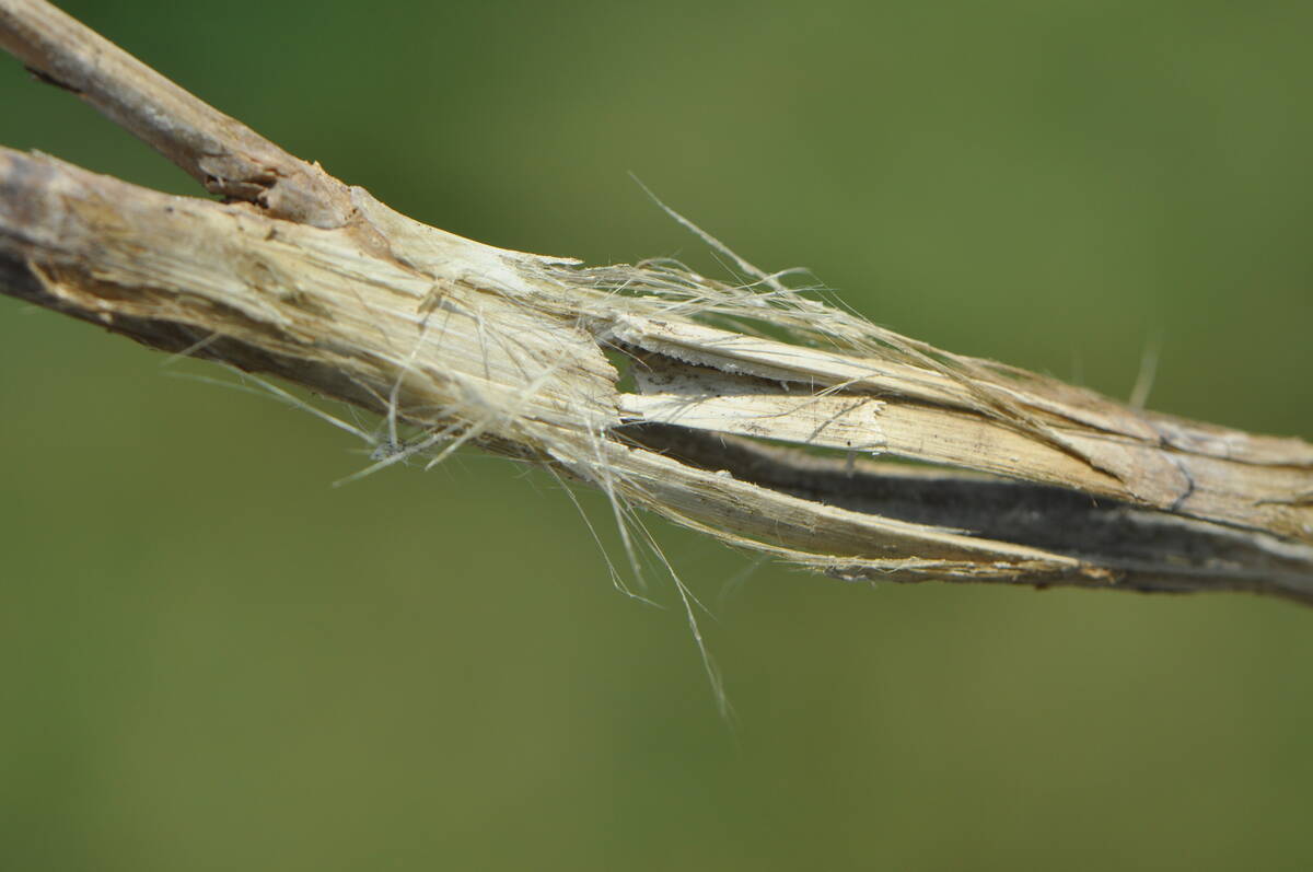
“It can be used for scouting various stages of the crop at various heights,” Picard said. “A crop like canola at full flower is hard to walk through. The same with corn or sunflowers when they get much taller. Then you can hardly see beyond the first few rows so this would potentially give us access to see the whole field and even parts of the field because we can hover down to those areas. It could help us identify areas of concern or damage from hail, spray drift, diseases or insects.”
Hail damage is often difficult to assess from the ground, but an aerial view provides “the big picture.”
It’s a quick way to check a crop and it’s non-invasive — something of increasing importance as farmers try to keep visitors from introducing pests to their land.
Aerial pictures also provide a historical record of a field.
Picard’s ’copter can fly for 20 to 25 minutes up to 1.3 kilometres from the operator.
Crop scouting is an obvious use for drones, but it’s not hard to think of more, including checking cows and fences.
“If a cow was having a calf (on pasture) you could check what’s going on without disturbing the whole herd,” Picard said. “There’s an element of safety. You never know when an animal (during birthing) will turn on you. It’s one less time you’d have to be exposed to that risk.”
In addition to being a useful tool, there’s no denying it’s also fun to fly the drone, he said.
“I expect drones could turn up on a lot of farmers’ Christmas wish lists this year.”