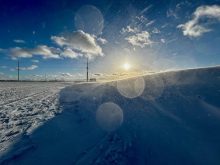
With parts of southern and central Manitoba seeing their first flakes of snow last weekend, I thought it would be a good time to begin a look at the topic of snow. The snow last weekend came thanks to the first Alberta Clipper of the year, which brought upwards of five cm of snow to some regions of western Manitoba. Farther east, areas to the lee of Lake Winnipeg and Lake Manitoba saw some lake-effect snow.
Manitoba occasionally sees lake-effect snows in late October and early November in the areas around Lake Manitoba and Lake Winnipeg. So, for our first snow article I thought we should take a look at what lake-effect snow is and what causes it.
Read Also

Understanding wind chill
How wind chill actually impacts how cold you feel this winter, plus gift ideas for the weather nerd in your life
Lake-effect snows are exactly that — snowfall created solely by the moisture and energy contained within a lake. Usually when we get snowfall it comes from storm systems which are areas of low pressure. These systems bring moist air and force it to rise, condense and then form snow. With lake-effect snow you don’t need an area of low pressure; all you need is a large difference in temperature between the water and the air.
Ingredients
The first and most important ingredient you need for a lake-effect snow is warm water/moisture. Here in Manitoba our large lakes have some heat storage, but since they are so shallow they quickly lose their heat in the fall. This means we only have a short period in the late fall and early winter when open water and large amounts of heat are available.
The Great Lakes, on the other hand, are much deeper and can therefore store huge amounts of energy. With the exception of Lake Erie, it is rare for any of the Great Lakes to totally freeze over during the winter. This means there is plenty of warm, moist air available, especially in early winter when the lakes are still fairly warm.
The second key ingredient is cold air. While the open water can supply plenty of moisture, what really comes into play is just how cold the air is over the lake. The colder the air, the lower the air’s ability to “hold” moisture. This means that any moisture picked up over the lake will be quickly turned into snow as it rises and cools.
The third piece of the lake-effect snow puzzle is wind fetch. This is basically the distance or length of time the wind is blowing across a lake. The longer the wind can blow across the water, the more heat and moisture it can pick up. In Manitoba, our major lakes run in a north-south direction. So for us to see any significant lake-effect snows we need to have winds blowing from the north or northwest.
The last couple of mechanisms are friction and upslope lift. As the wind blows from the relatively smooth surface of the lake to rougher land surfaces, the air encounters increased friction, which slows the windover the land, causing the air coming off of the lake to pile up. This forces the air to rise as it has nowhere else to go, which helps it to cool and form snow. In some areas the height difference between the lake and the land also helps to lift the air and cool it, thus enhancing snowfall.
Snowfall can be heavy
To summarize, as cold air moves over a body of water, the heat and moisture from the water is picked up by the air. This warm, moist air will then begin to rise up into the atmosphere. As the air rises it expands and cools, allowing the moisture picked up from the lake to condense into ice crystals and eventually form snow which falls downwind or on the lee side of the lake. Unlike snowstorms that usually only last a day or two, lake-effect snows can, if the atmospheric conditions are just right, last for several days — creating some truly remarkable amounts of snow.
In Manitoba, lake-effect snows usually only last for few hours, but there can be the occasional persistent band of snow. Usually these bands only drop a couple of centimetres of snow, but there have occasionally been larger dumps.
It is hard to look back at the climate records and pull out lake-effect snows, so I don’t really have a record of what the largest ones were. Simply going by memory I would say that 20 to 30 centimetres is probably the top end for our area. If anyone has some numbers on this I would appreciate it.
Looking at the Great Lakes, record snowfalls from lake-effect snow can be truly remarkable. The largest event that I was able to find occurred in February 2007 when a multi-day event dropped upwards of 358 cm of snow on the Tug Hill Plateau in New York state! What is truly remarkable about these snow events is the intensity of snowfall, bringing huge amounts of snow in a short period.
Here are some other record snowfall rates/accumulations from lake-effect snows.
- 17.5 cm in 30 minutes at West Seneca, New York on Dec. 2, 2010
- 25 cm in one hour at Copenhagen, New York on Dec. 2, 1966
- 44 cm in two hours at Oswego, New York on Jan. 26, 1972
- 56 cm in three hours at Valparaiso, Indiana on Dec. 18, 1981
- 130 cm in 16 hours at Benetts Bridge, New York on Jan. 17-18, 1959
- 195 cm in 24 hours at Montague Township on the Tug Hill Plateau, New York on Jan. 11-12, 1997