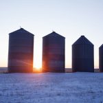
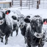
(Keeperofthezoo/iStock/Getty Images)

Prairie Forecast: Winter temperatures try to move in

Issued Nov. 22, covering Nov. 22-29

There is a large, deep area of low pressure spinning over the northern half of Hudson Bay along with a building area of high pressure over the Yukon. The counterclockwise rotation around the Hudson Bay low will create a north to northwesterly flow across the Prairies. This will allow the Yukon high to drop southward.

File photo of storm clouds over northeastern Alberta. (ImagineGolf/E+/Getty Images)

Prairie forecast: One more shot of warm weather?

Issued Nov. 14, covering Nov. 15 to 18

It looks like the well above average temperatures that flooded across the prairies over the last week or so will be coming to an end, at least eventually. The good news is that it doesn't look like it will be an abrupt end with well below average temperatures moving in.


(Mysticenergy/iStock/Getty Images)

Prairie Forecast Update: Warmer air not in the cards

Issued Oct. 29, covering Oct. 29 to Nov. 1

The forecast for this period has been playing out pretty close to what the weather models were predicting, but with a few small differences. For Alberta, the forecasted upper ridge does not look like it will get nearly as strong as originally forecasted as a strong northwesterly flow helps to flatten the ridge. This means

Fresh snow on an ornamental crabapple tree in Winnipeg, Oct. 25, 2023. (Dave Bedard photo)

Prairie Forecast: Arctic high slowly moving out

Issued Oct. 25, covering Oct. 25 to Nov. 1

As is often the case at this time of the year, the weather models got the general picture right, but the finer details were much to be desired. Usually, the models struggle with the forecast beyond two to five days out, but for much of this forecast period they struggled with the finer details on


A black-billed magpie in Edmonton on Oct. 19, 2023. (Photo: Artur Widak/NurPhoto via Reuters)

Prairie Forecast Update: Cold and some snow coming

Issued Oct. 22, covering Oct. 22 to 25

I have been waiting to see if the weather models were going to come into agreement on the upcoming shift on our weather pattern and for the most part, they have: it’s going to get cold! A large area of low pressure has formed over the eastern Arctic and the counterclockwise rotation around that low

File photo of the northern lights over snow and stubble on a Saskatchewan field. (Nancy Anderson/iStock/Getty Images)

Prairie Forecast: Warmer, colder… then snow?

Issued Oct. 18, covering Oct. 18-25

Not surprisingly for this time of the year, the last forecast didn’t play out exactly as expected, but overall, it was pretty darn close. The large area of high pressure that was forecasted to develop over the northern Prairies and slowly drop southward did just as forecast, but over the first few days the high


File photo of beluga whales in Hudson Bay off Churchill, Manitoba. (Lynn_Bystrom/iStock/Getty Images)

Prairie Forecast Update: Manitoba in retrograde

Issued Oct. 7, covering Oct. 7-11

If you have followed my forecasts over the years, you will know that the term retrograde is almost always associated with bad weather. Well, an area of low pressure about to come on shore over Eastern Canada is expected to retrograde, or move westward, ending up around James Bay by Monday or Tuesday. How will

File photos of Yukon ranchland. (StockstudioX/iStock/Getty Images)

Prairie Forecast: Building western ridge to bring warming trend

Issued Oct. 4, covering Oct. 4-10

Last week’s weather forecast played out close to what the weather models were predicting. Western regions saw cooler-than-average temperatures move in, while eastern regions saw a brief return to summer-like temperatures. This pattern was a response to an area of low pressure that spun up over the central U.S. during the second half of the