Photo: Thinkstock

Prairie forecast: Potential to turn cool and wet

Forecast issued July 9, covering July 9 to 16, 2025

For this forecast period we are starting off with a large area of high pressure over Ontario and an equally large area of low pressure over the Yukon. The clockwise flow around the Ontario high, combined with the counterclockwise flow around the Yukon low, is creating a widespread southerly flow across the Prairies. This should lead to one more day of warm temperatures across the western Prairies and a couple more days over the eastern half.


Photo: Vencavolrab/iStock/Getty Images

Prairie forecast: Looking warm and dry for Canada Day

Forecast issued June 25, covering June 25 to July 2, 2025

A broad but unorganized area of low pressure impacts all three Prairie provinces for at least the first half of this forecast period. Unsettled weather means it will be a difficult forecast to pin down. It also means seasonable temperatures with no big intense heat waves expected—though that doesn’t mean we won’t see a few hot days.

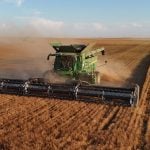
An alfalfa crop is harvested near Stonewall, Man.

First Manitoba hay harvest short

Manitoba’s first hay cut of 2025 isn’t great by initial counts, but things are worse farther west in the Prairies

Manitoba’s first hay cut of 2025 isn’t huge by initial counts, but things are worse farther west in the Prairies

Photo: File

Prairie forecast: Unsettled weather ahead

Forecast issued June 18, covering June 18 to 25, 2025

For this forecast period we start, once again, with no strong systems impacting the Prairies. But, as we head into the weekend a strong area of low pressure is forecasted to develop over the western U.S. This low will impact our region over the weekend, but how and where is a little uncertain.


Photo: Lisa Guenther

Prairie forecast: Where did the summer heat go?

Forecast issued June 11, covering June 11 to 18, 2025

Looking at the big picture we start this forecast period with a generally zonal flow across the Prairies as Arctic high pressure slides across the far northern Prairies and weak low pressure moves by to the south. This will bring sunny to partly cloudy skies and near to slightly below-average temperatures.


Photo: Allan Dawson/File

Prairie forecast: Hot east, cool west

Forecast issued May 7, covering May 7 to 14, 2025

We saw a strong ridge of high pressure build in last week, which brought daytime highs into the low thirties across parts of the eastern Prairies. Once the ridge collapsed, cooler air moved back in. Well, it looks like we can expect another cycle of building and collapsing ridges. Then, starting on the weekend, the weather pattern should become more energetic thanks to a strong trough of low pressure forecasted to develop off the West Coast.

This visible satellite image, taken on April 24 around 3pm covers most of southern and central Saskatchewan and Manitoba. It clearly shows the area of snow that fell earlier in the week across southeastern Saskatchewan. It also demonstrates how the cold air over top of the snowy region and the ice covered lakes inhibits cloud formation.

Neither rain, snow, sleet or hail…

It can be tough to tell the various precipitation types from each other

Farmers on the Prairies can expect to see all types of precipitation in the spring and early summer, including snow, rain, sleet and hail.