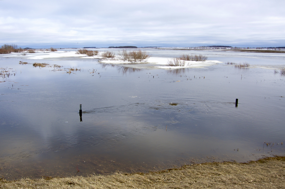
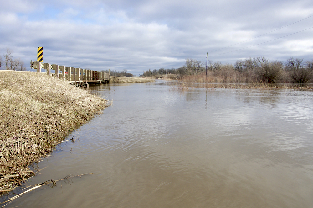
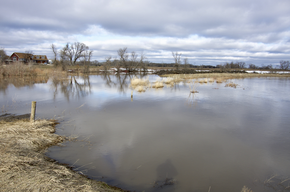
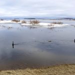
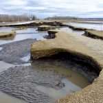
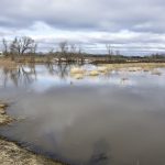
Tressel pasture Altamont May 2
Water still to come off the Manitoba escarpment backs up into a pasture near Altamont May 2.
Photo: Alexis Stockford
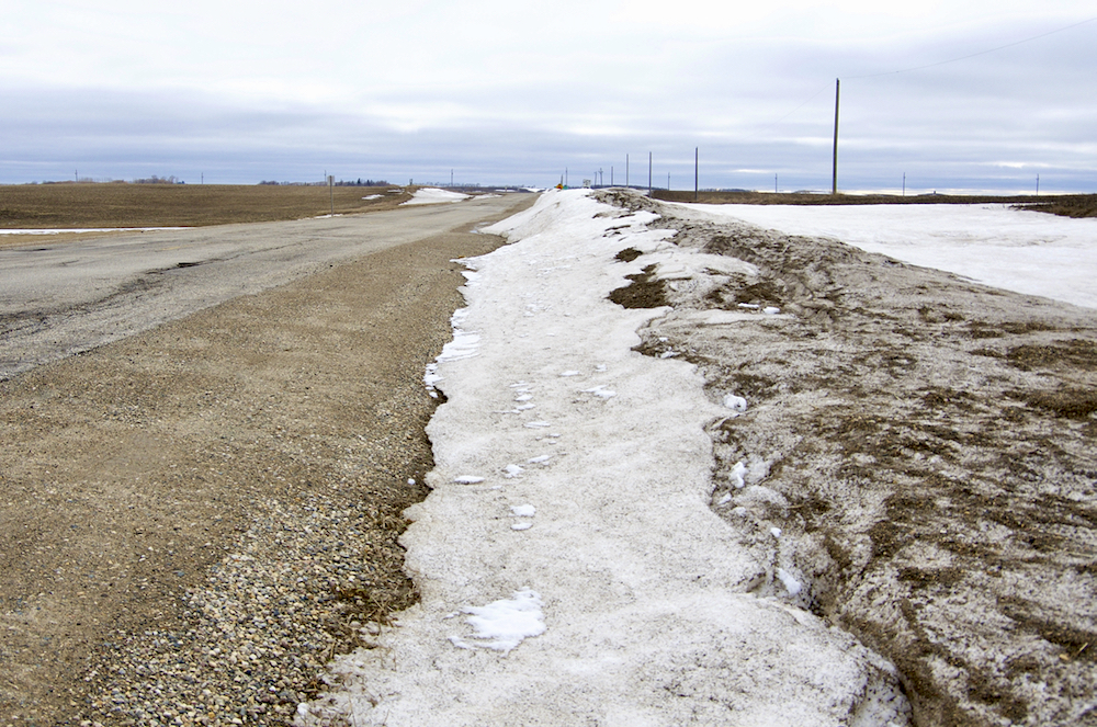
Snowpack Notre Dame May 2
Ditches near Notre Dame de Lourdes remain packed with snow as flood waters hit communities below the Manitoba escarpment.
Photo: Alexis Stockford
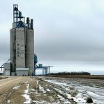
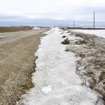
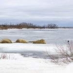
Snowpack Altamont May 2
Water begins to move off the Manitoba escarpment May 2.
Photo: Alexis Stockford
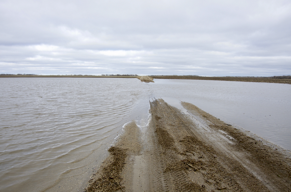
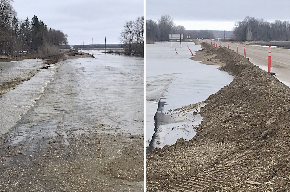
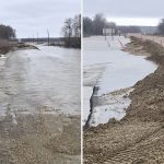
Roseisle road May 2
Municipal roads, such as this one in the R.M. of Thompson, went under water in the last weekend of April after the third Colorado low to hit the region in as many weeks.
Photo: Alexis Stockford

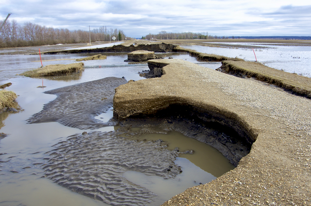
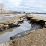
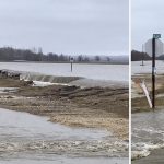
Road wash out PR 240-2
Flood waters leave extensive damage to PR 240, just below the Manitoba escarpment, May 2 after the third Colorado low to hit the region in as many weeks.
Photo: Alexis Stockford
Road wash out PR 240 May 2
Flood waters leave extensive damage to PR 240, just below the Manitoba escarpment, May 2 after the third Colorado low to hit the region in as many weeks.
Photo: Alexis Stockford
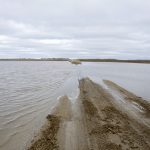
flood2-wstockford
Overland flooding east of Roseisle around the junction of PR 245 and PR 240 on April 30, 2022.
Photo: Wanda Stockford
flood1-wstockford
Overland flooding east of Roseisle around the junction of PR 245 and PR 240 on April 30, 2022.
Photo: Wanda Stockford
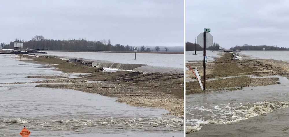
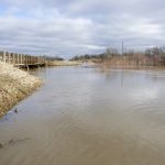
Bridge Boyne backup May 2
The backed-up Boyne River rushes just below bridge capacity north of Roseisle May 2.
Photo: Alexis Stockford
Boyne backup May 2
The Boyne River spills its banks north of Roseisle May 2, despite water levels declining from peaks over the weekend.
Photo: Alexis Stockford
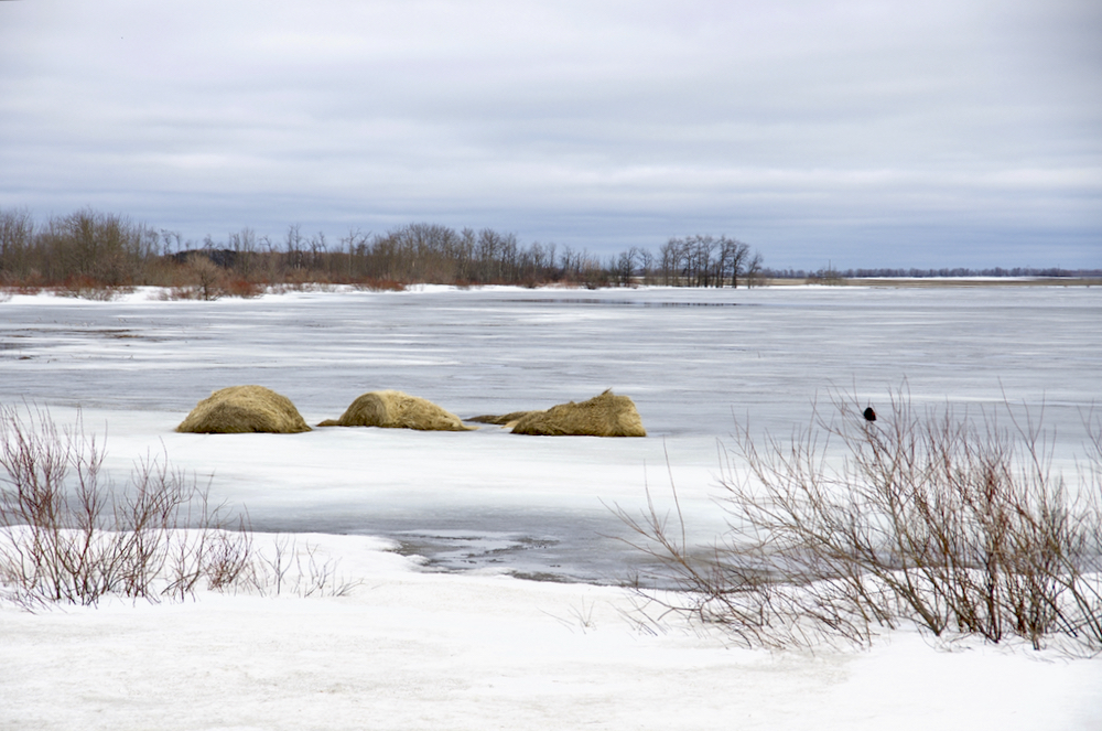
Bales Snowpack Altamont May 2
Water and ice from the remaining snowpack partly submerge bales along Highway 23 near Altamont May 2.
Photo: Alexis Stockford
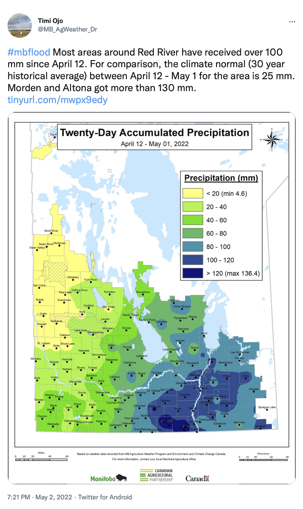
Ojo-tweet-05020222
Photo: Twitter/@@MB_AgWeather_Dr
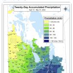
To say that southern Manitoba has not been lacking in moisture in the past several weeks would be an understatement.
Since early April, precipitation has descended on the province as gently falling snow, blizzard conditions and after this past weekend, what felt like a seemingly non-stop deluge of rain.
In a Twitter post on May 2, Timi Ojo with Manitoba Agriculture said that most areas received over 100 mm of precipitation since April 12. Ojo went on to note that the 30-year historical average between April 12 and May 1 is 25 mm for the area.
Read Also
MBFI livestock research farm gets major expansion
Manitoba Beef & Forage Initiatives expands Brookdale Research Farm by 467 acres to benchmark grazing profitability at commercial scale.
A ‘Twenty-Day Accumulated Precipitation’ graphic (view gallery) shows that the Morden and Altona areas exceeded 130 mm during this period.