News of an expected major flood along the Red River this spring created an undercurrent of urgency at the Red River Basin Commission’s annual convention last week.
A focus on flood control reflected the inescapable reality that the river is a perennial flood risk waiting to happen. The reason is simple. “We live in the bottom of a lake,” Chad Engels, a water resources engineer from West Fargo, N.D., told the convention, which took “Reflections on the Red” as its theme.
Read Also

Mazergroup’s Bob Mazer dies
Mazergroup’s Bob Mazer, who helped grow his family’s company into a string of farm equipment dealerships and the main dealer for New Holland machinery in Saskatchewan and Manitoba, died July 6 from cancer.
“We live in a flood plain.”
Meandering through the flat, fertile valley of ancient glacial Lake Agassiz, the Red River has a watershed of 116,500 square kilometres. From its source at Lake Traverse in South Dakota to its final destination at Lake Winnipeg in Manitoba, the Red extends for 885 km.
Along the way, it falls 70 metres in elevation, ensuring flood waters, when they rise, will sweep the length of the valley.
“We live in the worst place,” said Lance Yohe, the RRBC’s executive director. “We all live where the water wants to flow north.”
The risk of periodic flooding is heightened by the fact that the Red River basin is in a wet cycle. According to state statistics, eastern North Dakota has received above-normal seasonal rainfall for most of the last 30 years.
Fifteen counties in the region experienced 16 or more flood-related disaster declarations since 1989. Another dozen counties had 10 or more. The long-term evidence suggests the region may be prone to wet cycles.
Historical data, including tree ring analysis, indicates the Red River Valley has been wet 65 per cent of the time over the last 400 years, said Patrick Foley of the U.S. Corps of Engineers.
In addition, weather models project a slow, steady temperature increase for the region over the next 30 years. Research indicates that precipitation in the region increases two-thirds of the time when temperatures rise, Foley told the meeting.
“With climate change, things could get worse,” he said. Presentations on long-term flood solutions dominated the agenda with speakers detailing a range of options.
John Jaschke, executive director of the Minnesota Board of Water and Soil Resources, described three systems to keep flood waters at bay: dams, diversions and upstream water retention storages.
Of the three, storages may be the most effective because they slow the flow by temporarily holding back water along tributaries and in uplands, Jaschke said. Storage sites can include previously drained wetlands and old river channels, he added.
But Engels warned water retentions are no silver bullet for flood control. While they may lower the flow on tributaries, retentions do little to alleviate mainstream water levels themselves.
Communities situated on the Red River still require dikes to hold back water and channels to divert it, Engels said.
Flood control strategies for the Red River basin are compounded by the fact that the region is multi-jurisdictional, involving two states and one province within two countries with different systems of government. Geographically, the United States dominates the basin. Ninety per cent of the Red River’s watershed lies within U.S. territory.
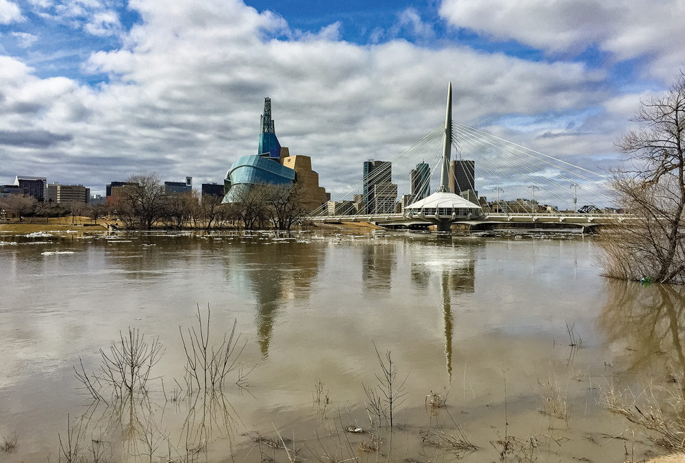
But because the river ends its journey in Manitoba, residents feel they invariably get the worst of any flooding which occurs.
For that reason, Manitoba has been proactive in implementing flood control measures. The prime example is the Winnipeg Floodway, which has saved the city from flood damage many times since its first use in 1969.
Following the record 1997 flood, Ottawa and the province funded a major flood-proofing program for the Red River Valley. Besides strengthening ring dikes for towns along the river, the program also funded earth-moving works to help rural residents dike or raise the level of homes and buildings.
Herman Martens, outgoing chair of the Red River Basin Commission, said the approach to water control has changed greatly from 50 years ago, when landowners built “the Autobahn of waterways” to drain the land as fast as possible.
Since then, there’s been a big shift in dealing with overland flooding, said Martens, the former reeve of the Rural Municipality of Morris. Instead of getting rid of water by dumping it onto a neighbour’s property, people now work together to manage it as a resource, he said.
That approach also applies to the RRBC, a binational not-for-profit organization which facilitates a co-operative approach to water management within the basin, Martens added.
“It’s our basin. It’s not Canadian or American.” [email protected]
———
“Weliveinthebottomofalake.”
– CHAD ENGELS