Manitoba could see anything ranging from moderate to severe overland flood risk this spring, according to a provincial “conditions report” issued Jan. 30.
Infrastructure Minister Blaine Pedersen said the report, issued earlier than usual and in addition to the expected late-winter forecast, is necessary because a combination of conditions has led to elevated risk.
“We have experienced some unusual winter weather to this point that has contributed to an expanded risk of overland flooding in Manitoba,” Pedersen said. “At this time, we need to be aware of the potential for flooding with the understanding that we have a couple more months of winter weather and the uncertainty of the spring melt rate.”
Read Also
The lowdown on winter storms on the Prairies
It takes more than just a trough of low pressure to develop an Alberta Clipper or Colorado Low, which are the biggest winter storms in Manitoba. It also takes humidity, temperature changes and a host of other variables coming into play.
Pedersen said the staff at the Manitoba Hydrologic Forecast Centre will continue to assess data over the coming weeks to refine future flood outlooks.
The potential for overland flooding is estimated as moderate to major in most areas of the province. The report notes this could change depending on weather conditions between now and the spring melt, with February and March flood outlooks further defining the flood potential.
At this time, with future unfavourable weather conditions:
- The Red, Souris, Pembina, Lower Assiniboine and Roseau rivers and the southwest region of the province are currently at risk for major flooding;
- The Upper Assiniboine River, eastern region, Winnipeg River, northern Manitoba and The Pas regions including the Saskatchewan, Carrot and Swan rivers, are currently at risk for moderate to major flooding, and;
- The Interlake region and the Fisher River are currently at risk for moderate flooding.
Flood forecasters look at six primary factors when assessing long-term prospects for potential spring floods, Pedersen said. In addition to soil moisture at freeze-up, other factors yet to be determined are winter snow, spring rain, how fast the snow melts, the depth of frost, and river and lake levels prior to spring run-off.
The provincial agency isn’t the only organization that’s keeping close tabs on the issue. The Assiniboine River Basin Initiative is watching the coming spring very carefully too, according to ARBI chair Allan Preston.
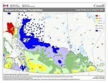
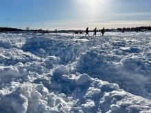
“While it is much too early to accurately forecast what spring may herald in terms of flooding, this winter’s heavy snowfall across the Souris River sub-basin in particular, coupled with saturated soil conditions over the entire Assiniboine basin, certainly have begun to raise some potential concerns,” Preston said.
Preston also said ARBI is determined to better understand the water movement across the basin and to help identify best practices for adaptability and resilience. One such model is the Manitoba Forage and Grassland Association (MFGA)’s Aquanty project. It will model the effects of flood and drought on soils and topography as well as simulating various mitigation measures to lessen flood and drought event impacts on agricultural lands.
The Manitoba government and municipalities are continuing to prepare for spring flooding. This includes working with municipal emergency management teams to review existing emergency response plans and sharing information through conference calls and flood information seminars in Morris, Brandon and Selkirk.
The first full flood outlook is expected at the end of February.


