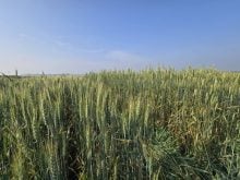
We know that life on an old glacial lake bed means periodic — and sometimes spectacular — spring flooding.
In future we may also see greater amounts of summer rain as the climate warms and that could mean more frequent, locally destructive floods throughout the growing season.
Building local climate resilience means managing more water on flat land so the first task at hand is accurate ground surveying with something like LiDAR, Light Detection and Ranging, a laser-based mapping technology.
Read Also
FieldView prescriptions can now move wirelessly to John Deere Operations Center
A new integration between Bayer’s FieldView platform and John Deere Operations Center lets farmers send variable-rate prescriptions directly to connected equipment without USB drives. As-applied data flows back automatically for post-season review.
“We need to understand what LiDAR can bring to all communities and it’s a great teaching tool for all who wish to learn.” said Steve Strang, Manitoba director of the Red River Basin Commission. “It’s a tool that allows us to adapt to the ongoing changes that we are seeing in our weather.”
The commission was set to hold meetings in Manitoba municipalities to bring the word to councillors and watershed managers about using LiDAR data for water management and project planning. The COVID pandemic made that impossible so, as an alternative, they produced a LiDAR manual with a series of videos due for release very soon. In this way members of different municipalities can learn how to use this data to their benefit.
“For those who have LiDAR experience some of this may not be new but for those who don’t, we see this as the beginning,” Strang said. “We feel it’s important to share the technology and allow everybody to take advantage of it.”
- Read more: What is LiDAR?
The initial push for LiDAR surveys began in 1997 when a huge flood deluged the Red River Basin. The flood caused massive amounts of damage throughout southern Manitoba and wreaked havoc on Minnesota and North Dakota. Grand Forks bore a terrible cost not only with the flooding but with a serious fire that burned 11 major buildings in its downtown.
In the aftermath of the ’97 disaster, the northern basin states began looking at better ways to deal with potential flooding starting with better ground surveys. They saw LiDAR as a cost-effective way to develop accurate mapping of land slope and flat areas for water management.
“It was after this event that Minnesota, North and South Dakota began the collection of LiDAR data to help build a more proactive approach to flood preparation,” Don Wiebe, of the Red River Basin Commission, said. “By 2006 the States had completed its collection of LiDAR data and now we’re finally catching up on the Manitoba section.”
“Manitoba is not totally flown and we certainly want to encourage our provincial partners to try to budget more and try to pick up more data as we all go forward,” Strang added. “We understand the value of what it is.”
And that brings us to that manual and videos the basin commission has produced. There are 13 videos altogether. The first six explain how LiDAR works and how the data is collected. The next seven illustrate what this data means to those who live in the basin.
“The videos go alongside the manual and you do them section by section,” Strang said. In each section you’re given the opportunity to do hands-on learning. The videos provide a visualization of how to do something and with the pictures that are in the manual, you get step-by-step instructions that will guide you through the training.”
There are any number of things you can do using LiDAR-based information. It captures small differences in elevation and, on the Prairies, this is really important because the slightest slope will determine which way the water will run. This kind of information can be crucial to a watershed manager looking at where to dig drainage ditches, where to build a dike or where you might place a retention pond.
It could be just as important to a municipal council granting a permit to put up a building. Drier ground would be better for business and more insurable in the long term. Overall it makes farms, towns and businesses more resilient.
“LiDAR is the gift that keeps on giving,” said Hank Venema of Strategic Systems Engineering. “We are concerned about climate change and the increased frequency of floods and droughts. The challenge before us is to relearn the wisdom of the Prairie Farm Rehabilitation Administration, the good old PFRA. As it got us out of the dust bowl it really focused on water harvesting and what we now call national infrastructure as the way to adapt to and recover from drought.”
He went on to say that we have to relearn the logic and wisdom it developed back then and apply it with a technology it never dreamed of. Having a detailed map of land elevation can help us manage land and water with minimum environmental degradation and maximum positive environmental impact in a new culture of water harvesting or either drought or flood protection.
“This will be put online and made available,” Strang said “You could go on to the website at www.redriverbasin.org or you can call our office.”