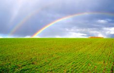
MarketsFarm — Large areas of Western Canada remain on the dry side, with little moisture in the immediate forecasts.
And while it’s still early in the growing season, the interplay of conflicting patterns from the south and north will determine whether the dry areas receive timely precipitation during the growing season.
“We are looking at a fairly large area of the Prairies continuing to degrade over the past two weeks,” said Trevor Hadwen of Agriculture and Agri-Food Canada’s Drought Watch department in Regina.
Read Also

Dryness poised to threaten Saskatchewan crops
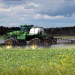
Crops in Saskatchewan are developing in opposite directions, the province’s latest crop report said. Growing conditions in the province vary, with some areas receiving enough rain while other locations are experiencing crop stress due to hot, dry conditions.
Central Saskatchewan was the worst off, he said, with very little moisture this spring and some areas entering their third year of drought conditions.
Western Manitoba and eastern parts of Alberta are also dry, according to Drought Watch data.
In areas that are already seeded, much of the crop is lying dormant or only seeing spotty germination, according to Hadwen. Some producers have reportedly stopped seeding until they get more moisture. Switching acres to shorter-season crops remains a possibility.
“It’s too early to talk about leaving land fallow or writing off the whole crop,” said Hadwen, adding that the pasture situation was more of an issue.
Feed supplies were already tight and producers moved their cattle out to grass early in many areas. Cool and dry conditions have slowed grass growth, heightening the risk of overgrazing. Hadwen encouraged supplemental feeding in order to reduce pressure on pastureland.
“One good rain will provide some optimism, especially in those areas that are already doing a little better,” said Hadwen. However, he added, there was little precipitation for the driest areas in the immediate forecasts, with moisture reserves already depleted.
“It’s all about the U.S.,” said meteorologist Drew Lerner of World Weather Inc. in Kansas.
Heavy rains hitting the U.S. Midwest were effectively keeping the moisture from moving north into Canada, he said. The wet fields there will take some time to dry out, which will slow the movement of the jet stream.
A conflicting influence caused by warmer water in the Gulf of Alaska was also limiting moisture from the west.
Lerner forecast a status quo of limited shower activity and cooler temperatures over the next two to three weeks, aside from the most southern parts of the Canadian Prairies.
The jet stream is then forecast to move north into the second week of June, bringing some more significant moisture to the southern Prairies. However, Lerner said, northern parts of Saskatchewan and Alberta may have a tougher time getting the moisture due to the continued influence from the Gulf of Alaska.
“The two patterns will fight each other over the summer,” said Lerner. He expected the northern Prairies would not see a high volume of rain, but should see timely showers to help with crop development.
“If one (weather influence) becomes stronger than the other, it could rewrite the whole outlook.”
— Phil Franz-Warkentin writes for MarketsFarm, a Glacier FarmMedia division specializing in grain and commodity market analysis and reporting.