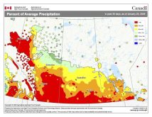
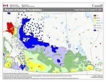
As I pointed out in last week’s forecast, it looks as if our general weather pattern has definitely undergone a switch to what looks to be a bit more active. This could mean we’ll finally get some much-needed precipitation.
Eastern regions saw some of this precipitation last week when a Colorado low brought upwards of 10-20 centimetres of snow. Farther west, an Alberta clipper-type system brought some much-needed snow over the weekend. By Wednesday this week, a strong Colorado low looks to bring a very heavy dump of snow to our southern neighbours, so it doesn’t look like winter is over yet!
Read Also

Trade uncertainty, tariffs weigh on Canadian beef sector as market access shifts
Manitoba’s beef cattle producers heard more about the growing uncertainty they face as U.S. tariffs, and shifting trade opportunities, reshape their market.
This active weather pattern looks to continue as the models show another area of low pressure moving through southern Manitoba on Friday, which will likely bring a few centimetres of snow with it. This will be followed by some cooler conditions over the weekend as our winds become northerly behind the departing low.
The weather models then show another strong storm system moving in from Alberta early next week. Currently they show this system moving through central regions, which would mean most of the snow will fall in the northern parts of agricultural Manitoba. Southern regions will still see some snow, but amounts will not be that great. While temperatures will moderate a little bit ahead of this low, cooler air will move in behind it.
Yet another area of low pressure is forecast to move through around the middle of next week. This low does not look to be that strong, so not much in the way of snow is expected. A fifth area of low pressure is expected to develop later next week, but this one is forecasted to take a much more northerly route. This would result in a return to milder conditions by next weekend.
Usual temperature range for this period: Highs, -13 to +1 C; lows, -26 to -9 C.


