Another month has come and gone and, from a weather point of view, I think the best way to sum up July would be to say that it was typical. We saw some rain, a few severe storms, plenty of sunshine, and clouds for that matter, and relatively warm temperatures. What we didn’t see were any unusual hot or cold snaps. I guess instead of using the word typical to describe July’s weather we can simply say the weather was average.
When we look at the numbers for the month we find that both Dauphin and Winnipeg came in a little above average in regards to temperature. Dauphin’s mean monthly temperature was 18.8 C compared to the long-term average of 18.4 C. Winnipeg was the hot spot in July coming in with a mean monthly temperature of 20.2 C which was 0.7 C above the long-term average of 19.5 C.
Read Also

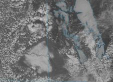
Why is the sky blue?
The colour of the skies, on the Prairies and elsewhere, tells the story of the paths sunlight takes as it enters Earth’s atmosphere, Daniel Bezte writes.
COOL SPOT
Brandon was the one cool spot during July, coming in 0.6 C below average with a reading of 18.3 C, but Environment Canada has a bad temperature reading in the data set used to calculate this number as it indicates the overnight low on July 14 was -1.5 C instead of being about 10.5 C. This would skew the overall mean temperature for the month downwards, so Brandon probably did come in around average, not below. So overall, I would say temperatures during July were right around average.
If we take a closer look at temperatures we find them to be fairly consistent from day to day. As I pointed out earlier, we did not see any really big heat waves or cold snaps during July. Winnipeg and Brandon only saw one day with temperatures warmer than 30 C during July, while Dauphin topped out around 29 C. On the other side of the coin, none of our three main sites had more than one day during July that didn’t see daytime temperatures warmer than 20 C, and only a few nights had overnight lows cooler than 10 C, and of those, most were between 9 C and 10 C.
PRECIPITATION AVERAGE
Precipitation was also right around average for the month at all three of our main sites. Dauphin was the wet spot, recording 84 mm of rain, which was about eight mm above average. Winnipeg recorded 76 mm, within a couple of millimetres of average. Brandon was the dry spot, but only relatively speaking. During July, Brandon recorded about 64 mm rain, about eight mm below their long-term average. So, just like temperatures, rainfall during July was pretty much right on average.
Now the fun part, who was able to predict this average month? Looking back at the different predictions it looks like the honour goes to us here at theCo-operator. If you remember back to early July I decided to go against my gut feeling that was telling me it was going to be hot and dry, and I hedged my bet saying, and I quote, “I think I will hedge my bets and call for average conditions during July. Temperatures will remain fairly consistent over the month.” I had also called for near-average precipitation during July not bad…pat, pat, pat.
So that leaves us with our monthly million-dollar question, what will August bring us in the weather department? The overworked folks over at Environment Canada are calling for above-average temperatures along with near-average amounts of precipitation – gee that sounds not too bad!
HOT AND DRY?
The forecasters (or whomever comes up with the forecast) over at theOld Farmer’s Almanacare calling for both near-average temperatures and precipitation. At theCanadian Farmer’s Almanacthey seem to be calling for near-to above-average temperatures, as they mention hot once and pleasant temperatures several times. It also sounds like precipitation will be near to above average as they mention we should expect showers and unsettled conditions fairly often during the month.
Finally that leaves me here at theCo-operator.This time I am going to stick with my gut and call for warmer-than-average temperatures in August along with below-average amounts of precipitation. I am basing this on two different things. First of all is the fact that the medium-range computer models that currently forecast out to around Aug. 20 seem to be leaning towards warm and fairly dry conditions.
The second factor in my decision is that conditions over the Pacific Ocean for the past several months are very much like what occurred in 1998. Looking back to 1998 we had a cooler-than-average June (like we did this year), near-to slightly above-average July (again like this year), and then a well-above-average August (hopefully like we will have this year). Hopefully if this pans out, we’ll continue following 1998’s weather, as September of that year also turned out to be warmer than average. But as always, we will have to wait and see, because predicting the weather is never really that simple.