Dry soil and low river and lake levels will help — but a quick melt and more precipitation are the big worries now
The provincial government says flooding shouldn’t be as bad as in 2011, but in many areas it may come down to the effectiveness of its ice-breaking efforts.
“We could be into a very rapid melt during which that American water, or water in our tributaries, could meet up against solid ice,” said Steve Topping, director of Manitoba Infrastructure and Transportation’s water management division.
“So the ice-jam potential in Manitoba is very high.”
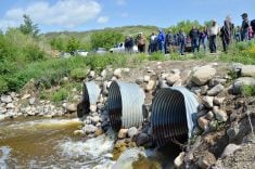
As of last week, 29 kilometres of ice had already been cut and broken along the Red River north of Winnipeg, and the province’s ice-breaking Amphibexes were working on the Assiniboine River at the Portage Diversion and near the Hood Bridge.
Read Also
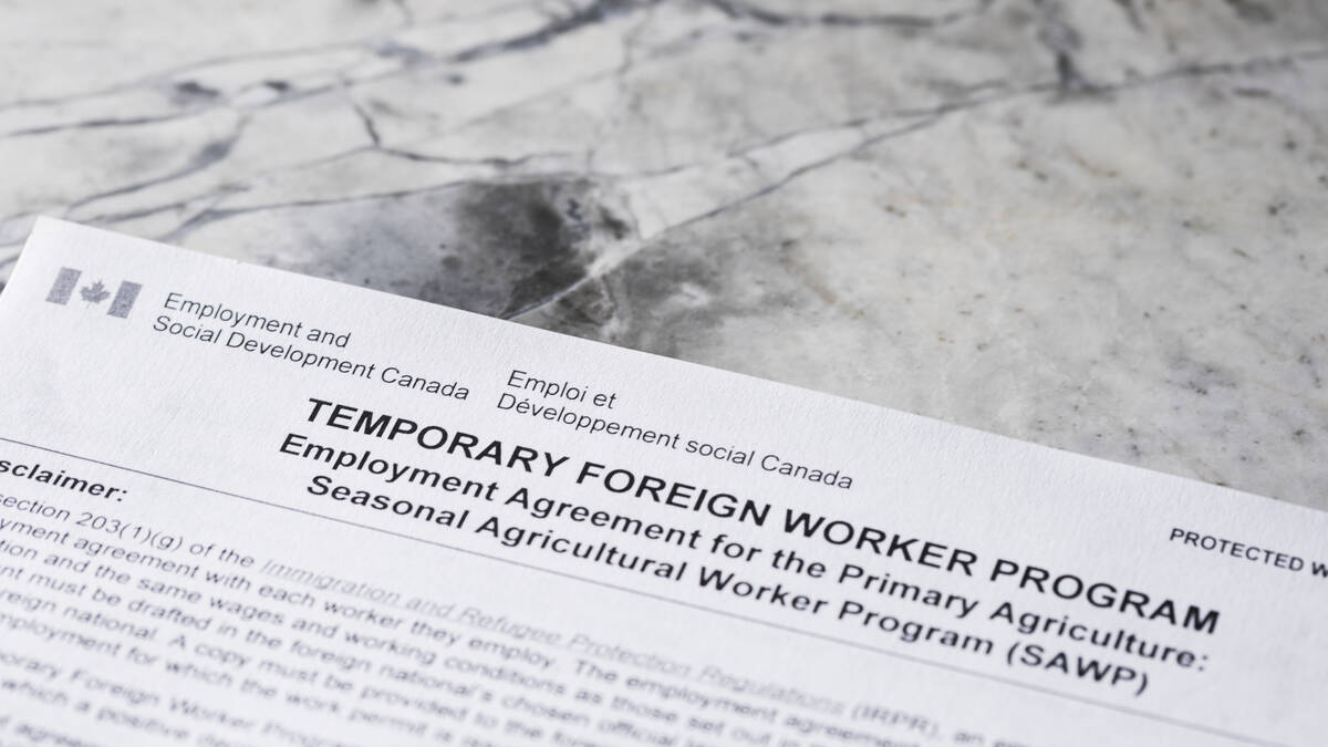
Meat sector shrugs at raised cap for rural temporary foreign workers
Federal moves to relax restrictions is unlikely to change much for agriculture or meat processing, where the real ask is permanent residency pathways.
Ice breaking is also occurring on the Fisher River, near Fisher River Cree Nation, while ice cutting has taken place on the Whitemouth and Icelandic rivers, said Topping.
“It’s a very aggressive ice-jam mitigation program,” said the director.
The latest provincial flood forecasts predict flooding similar to 2009, when ice jams caused significant damage to homes and properties on the Red River north of Winnipeg.
All of Manitoba’s major rivers have thicker-than-normal ice this year, and much of the province has received more than double its normal snowfall, said senior flood forecaster Phillip Mutulu.
Recent snowfalls have increased the potential for flooding on the Red, Souris, Pembina, Assiniboine, Saskatchewan and Qu’Appelle rivers.
Conditions are better than in 2011 because most rivers are below normal levels and soil conditions were dry at freeze-up, but much depends on how quick the thaw is and whether more snow or rain arrives.
But even with unfavourable weather, some communities hit hard in 2011 are expected to be spared this time around.
Topping said the towns of Souris and Wawanesa are not expected to reach flood stage, and noted diking has been completed around the town of Melita.
Prolonged flooding is not expected on either Lake Winnipeg or Lake Manitoba.
Water levels on those lakes, as well as Winnipegosis, are all below spring 2011 levels. Lake Manitoba is at 811.8 feet above sea level, below its historical long-term average of 812.12 feet.
But water in the three Shoal Lakes, still merged into one body of water following the flood of 2011, could rise as much as two feet this spring, if weather conditions are poor. That would bring lake levels 1-1/2 feet shy of the peak experienced two years ago. Even with dry conditions, the Interlake region could see minor flooding.
Mutulu said soil frost conditions will contribute to overland flooding in some areas.
“In addition to heavier-than-average snowfall contributing to an increased flood risk, cooler-than-normal temperatures have increased the depth of the soil frost,” he said. “Across southern Manitoba, it was frozen to a depth of between 50 centimetres to more than 100 centimetres.”
But Manitoba’s flood defences are stronger than ever, said Steve Ashton, the minister of Manitoba infrastructure and transportation.
“The difference is that year over year we’ve gotten better at mitigation and response, better able to deal with those kinds of floods,” he said.
“So even a flood that may be historic in terms of proportion can often have far less impact than previous floods.”